Kozłowo geodata
Kozłowo (Warmia-Masuria) is a populated place; located in Poland in Europe/Warsaw (GMT+2) time zone. With population of 3,000 people, there are 1040 cities with bigger population in this country. Compared to other cities in Poland, 87.5% of cities are located further ↓South; 62.4% of cities are located further ←West and 52.6% of cities have lower elevation than Kozłowo. Note1


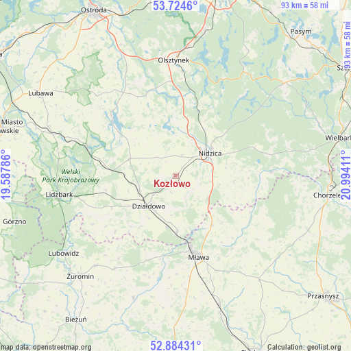
Kozłowo GPS coordinates[2]
53° 18' 23.472" North, 20° 17' 27.528" East
| Map corner | latitude | longitude |
|---|---|---|
| Upper-left | 53.7246°, | 19.58786° |
| Center: | 53.30652°, | 20.29098° |
| Lower-right: | 52.88431°, | 20.99411° |
| Map W x H: | 93.4×93.4 km | = 58×58mi |
| max Lat: | 54.83135° ⇑12.5% North |
| Kozłowo: | 53.30652° |
| min Lat: | ⇓87.5% South 49.21328° |
| min Long | Kozłowo | max Long |
| 14.20249° | 20.29098° | 24.03723° |
| W 62.4%⇐ | ⇒37.6% E |
Elevation
Elevation of Kozłowo is 179 m = 587 ft, and this is 12.4 m = 41 ft below average elevation for this country.
| Max E: |
974 m = 3196 ft | 47.4% |
| Avg. | 191.4 m = 628 ft | |
| Kozłowo | 179 m = 587 ft | |
Min E: |
-3 m = -10 ft | 52.6% |
See also: Poland elevation on elevation.city.
Geographical zone
Kozłowo is located in North temperate zone (between Tropic of Cancer and the Arctic Circle). Distance of this North polar circle is 1474 km =915.9 mi to North.| Distance of | km | miles | from Kozłowo |
|---|---|---|---|
| North Pole | 4079.9 | 2535.1 | to North |
| Arctic Circle | 1474 | 915.9 | to North |
| Tropic Cancer | 3321.2 | 2063.7 | to South |
| Equator | 5927.1 | 3682.9 | to South |


Nearby cities:
15 places around Kozłowo: (largest is in red/bold)
• Działdowo
11 km =6.8 mi,  227°
227°
• Dąbrówno
22.1 km =13.7 mi,  309°
309°
• Grunwald
23.7 km =14.7 mi,  326°
326°
• Iłowo -Osada
15.4 km =9.6 mi,  179°
179°
• Jabłonka
27.6 km =17.1 mi,  39°
39°
• Janowo
25.3 km =15.7 mi,  87°
87°
• Lipowiec Kościelny
23.7 km =14.7 mi,  198°
198°
• Mielno
23.9 km =14.9 mi,  344°
344°
• Mława
22.4 km =13.9 mi,  163°
163°
• Nidzica
10.9 km =6.8 mi,  56°
56°
• Płośnica
19 km =11.8 mi,  258°
258°
• Rybno
25.3 km =15.7 mi,  289°
289°
• Szydłowo
27.3 km =17 mi, 157°
• Wieczfnia Kościelna
17.5 km =10.9 mi,  135°
135°
• Wiśniewo
27.2 km =16.9 mi,  171°
171°
Sources, notices
• [Note1] Compared only with cities in Poland existing in our database
• [Src1] Map data: © OpenStreetMap contributors (CC-BY-SA)
• [Src2] Other city data from geonames.org with taken over terms of usage.
• [Src3] Geographical zone / Annual Mean Temperature by Robert A. Rohde @ Wikipedia
