Janowo geodata
Janowo (Warmia-Masuria) is a populated place; located in Poland in Europe/Warsaw (GMT+2) time zone. With population of 1,000 people, there are 2459 cities with bigger population in this country. Compared to other cities in Poland, 87.6% of cities are located further ↓South; 67.1% of cities are located further ←West and 64.4% of cities have higher elevation than Janowo. Note1


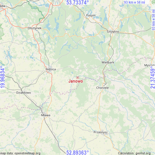
Janowo GPS coordinates[2]
53° 18' 56.7" North, 20° 40' 17.256" East
| Map corner | latitude | longitude |
|---|---|---|
| Upper-left | 53.73374°, | 19.96834° |
| Center: | 53.31575°, | 20.67146° |
| Lower-right: | 52.89363°, | 21.37459° |
| Map W x H: | 93.4×93.4 km | = 58×58mi |
| max Lat: | 54.83135° ⇑12.4% North |
| Janowo: | 53.31575° |
| min Lat: | ⇓87.6% South 49.21328° |
| min Long | Janowo | max Long |
| 14.20249° | 20.67146° | 24.03723° |
| W 67.1%⇐ | ⇒32.9% E |
Elevation
Elevation of Janowo is 135 m = 443 ft, and this is 56.4 m = 185 ft below average elevation for this country.
| Max E: |
974 m = 3196 ft | 64.4% |
| Avg. | 191.4 m = 628 ft | |
| Janowo | 135 m = 443 ft | |
Min E: |
-3 m = -10 ft | 35.6% |
See also: Poland elevation on elevation.city.
Geographical zone
Janowo is located in North temperate zone (between Tropic of Cancer and the Arctic Circle). Distance of this North polar circle is 1473 km =915.3 mi to North.| Distance of | km | miles | from Janowo |
|---|---|---|---|
| North Pole | 4078.9 | 2534.5 | to North |
| Arctic Circle | 1473 | 915.3 | to North |
| Tropic Cancer | 3322.2 | 2064.3 | to South |
| Equator | 5928.2 | 3683.6 | to South |


Nearby cities:
15 places around Janowo: (largest is in red/bold)
• Chorzele
16.2 km =10.1 mi,  112°
112°
• Czernice Borowe
31.7 km =19.7 mi,  174°
174°
• Dzierzgowo
18.1 km =11.2 mi,  181°
181°
• Grudusk
28.8 km =17.9 mi,  186°
186°
• Iłowo -Osada
30.1 km =18.7 mi,  236°
236°
• Jabłonka
21.5 km =13.4 mi,  339°
339°
• Jednorożec
31.9 km =19.8 mi,  127°
127°
• Jedwabno
24.1 km =15 mi,  8°
8°
• Kozłowo
25.3 km =15.7 mi,  267°
267°
• Krzynowłoga Mała
19.1 km =11.9 mi,  156°
156°
• Mława
29.6 km =18.4 mi,  220°
220°
• Nidzica
16.9 km =10.5 mi,  287°
287°
• Szydłowo
30 km =18.6 mi,  209°
209°
• Wieczfnia Kościelna
18.6 km =11.6 mi, 224°
• Wielbark
20.4 km =12.7 mi,  63°
63°
Sources, notices
• [Note1] Compared only with cities in Poland existing in our database
• [Src1] Map data: © OpenStreetMap contributors (CC-BY-SA)
• [Src2] Other city data from geonames.org with taken over terms of usage.
• [Src3] Geographical zone / Annual Mean Temperature by Robert A. Rohde @ Wikipedia
