Gać geodata
Gać (Podlasie) is a populated place; located in Poland in Europe/Warsaw (GMT+2) time zone. With population of 986 people, there are 2525 cities with bigger population in this country. Compared to other cities in Poland, 84.5% of cities are located further ↓South; 87.9% of cities are located further ←West and 79.3% of cities have higher elevation than Gać. Note1


Gać GPS coordinates[2]
53° 4' 47.64" North, 22° 14' 46.932" East
| Map corner | latitude | longitude |
|---|---|---|
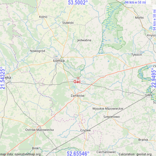
| Upper-left | 53.5002°, | 21.54325° |
| Center: | 53.0799°, | 22.24637° |
| Lower-right: | 52.65546°, | 22.9495° |
| Map W x H: | 93.9×93.9 km | = 58.3×58.3mi |
| max Lat: | 54.83135° ⇑15.5% North |
| Gać: | 53.0799° |
| min Lat: | ⇓84.5% South 49.21328° |
| min Long | Gać | max Long |
| 14.20249° | 22.24637° | 24.03723° |
| W 87.9%⇐ | ⇒12.1% E |
Elevation
Elevation of Gać is 101 m = 331 ft, and this is 90.4 m = 297 ft below average elevation for this country.
| Max E: |
974 m = 3196 ft | 79.3% |
| Avg. | 191.4 m = 628 ft | |
| Gać | 101 m = 331 ft | |
Min E: |
-3 m = -10 ft | 20.7% |
See also: Poland elevation on elevation.city.
Geographical zone
Gać is located in North temperate zone (between Tropic of Cancer and the Arctic Circle). Distance of this North polar circle is 1499.2 km =931.6 mi to North.| Distance of | km | miles | from Gać |
|---|---|---|---|
| North Pole | 4105.1 | 2550.8 | to North |
| Arctic Circle | 1499.2 | 931.6 | to North |
| Tropic Cancer | 3296 | 2048 | to South |
| Equator | 5901.9 | 3667.3 | to South |


Nearby cities:
15 places around Gać: (largest is in red/bold)
• Andrzejewo
27.8 km =17.3 mi,  186°
186°
• Czarnocin
18.7 km =11.6 mi,  322°
322°
• Jedwabne
23.2 km =14.4 mi,  9°
9°
• Mały Płock
28.8 km =17.9 mi,  329°
329°
• Miastkowo
29.8 km =18.5 mi,  285°
285°
• Nowogród
29.3 km =18.2 mi,  303°
303°
• Piątnica
16.4 km =10.2 mi, 322°
• Rutki
12.7 km =7.9 mi,  79°
79°
• Rutki-Kossaki
13 km =8.1 mi,  85°
85°
• Szumowo
20.9 km =13 mi,  211°
211°
• Wizna
15.7 km =9.8 mi,  35°
35°
• Wysokie Mazowieckie
25.6 km =15.9 mi,  135°
135°
• Zambrów
10.5 km =6.5 mi,  181°
181°
• Łomża
16.6 km =10.3 mi,  311°
311°
• Śniadowo
17.7 km =11 mi,  255°
255°
Sources, notices
• [Note1] Compared only with cities in Poland existing in our database
• [Src1] Map data: © OpenStreetMap contributors (CC-BY-SA)
• [Src2] Other city data from geonames.org with taken over terms of usage.
• [Src3] Geographical zone / Annual Mean Temperature by Robert A. Rohde @ Wikipedia
