Dołhobyczów geodata
Dołhobyczów (Lublin) is a populated place; located in Poland in Europe/Warsaw (GMT+2) time zone. With population of 1,491 people, there are 1885 cities with bigger population in this country. Compared to other cities in Poland, 65.5% of cities are located further ↑North; 100% of cities are located further ←West and 70.4% of cities have lower elevation than Dołhobyczów. Note1


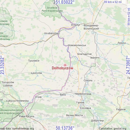
Dołhobyczów GPS coordinates[2]
50° 35' 9.276" North, 24° 2' 9.384" East
| Map corner | latitude | longitude |
|---|---|---|
| Upper-left | 51.03022°, | 23.33282° |
| Center: | 50.58591°, | 24.03594° |
| Lower-right: | 50.13736°, | 24.73907° |
| Map W x H: | 99.3×99.3 km | = 61.7×61.7mi |
| max Lat: | 54.83135° ⇑65.5% North |
| Dołhobyczów: | 50.58591° |
| min Lat: | ⇓34.5% South 49.21328° |
| min Long | Dołhobyczów | max Long |
| 14.20249° | 24.03594° | 24.03723° |
| W 100%⇐ | ⇒0% E |
Elevation
Elevation of Dołhobyczów is 230 m = 755 ft, and this is 38.6 m = 127 ft above average elevation for this country.
| Max E: |
974 m = 3196 ft | 29.6% |
| Dołhobyczów | 230 m 755 ft | |
| Avg. | 191.4 m = 628 ft | |
Min E: |
-3 m = -10 ft | 70.4% |
See also: Poland elevation on elevation.city.
Geographical zone
Dołhobyczów is located in North temperate zone (between Tropic of Cancer and the Arctic Circle). Distance of this North polar circle is 1776.5 km =1103.9 mi to North.| Distance of | km | miles | from Dołhobyczów |
|---|---|---|---|
| North Pole | 4382.4 | 2723.1 | to North |
| Arctic Circle | 1776.5 | 1103.9 | to North |
| Tropic Cancer | 3018.7 | 1875.7 | to South |
| Equator | 5624.6 | 3495 | to South |


Nearby cities:
15 places around Dołhobyczów: (largest is in red/bold)
• Horodło
34.3 km =21.3 mi,  0°
0°
• Hrebenne
32 km =19.9 mi,  357°
357°
• Hrubieszów
26.4 km =16.4 mi,  337°
337°
• Jarczów
36.6 km =22.7 mi,  240°
240°
• Komarów-Osada
39.7 km =24.7 mi,  276°
276°
• Michałów
30.8 km =19.1 mi,  261°
261°
• Mircze
12.3 km =7.6 mi,  306°
306°
• Miączyn
41.3 km =25.7 mi,  294°
294°
• Rachanie
34.9 km =21.7 mi, 261°
• Telatyn
15.3 km =9.5 mi, 244°
• Trzeszczany
33.6 km =20.9 mi,  321°
321°
• Tyszowce
24 km =14.9 mi, 278°
• Ulhówek
22.6 km =14 mi,  227°
227°
• Werbkowice
26.7 km =16.6 mi, 314°
• Łaszczów
22.7 km =14.1 mi, 255°
Sources, notices
• [Note1] Compared only with cities in Poland existing in our database
• [Src1] Map data: © OpenStreetMap contributors (CC-BY-SA)
• [Src2] Other city data from geonames.org with taken over terms of usage.
• [Src3] Geographical zone / Annual Mean Temperature by Robert A. Rohde @ Wikipedia
