Duque geodata
Duque (Naguabo) is a populated place; located in Puerto Rico in America/Puerto_Rico (GMT-4) time zone. With population of 1,529 people, there are 169 cities with bigger population in this country. Compared to other cities in Puerto Rico, 50.2% of cities are located further ↓South; 95.1% of cities are located further ←West and 63.1% of cities have lower elevation than Duque. Note1


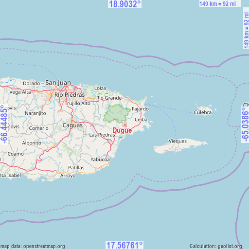
Duque GPS coordinates[2]
18° 14' 12.084" North, 65° 44' 30.192" West
| Map corner | latitude | longitude |
|---|---|---|
| Upper-left | 18.9032°, | -66.44485° |
| Center: | 18.23669°, | -65.74172° |
| Lower-right: | 17.56761°, | -65.0386° |
| Map W x H: | 148.5×148.5 km | = 92.3×92.3mi |
| max Lat: | 18.50078° ⇑49.8% North |
| Duque: | 18.23669° |
| min Lat: | ⇓50.2% South 17.95358° |
| min Long | Duque | max Long |
| -67.2499° | -65.74172° | -65.30099° |
| W 95.1%⇐ | ⇒4.9% E |
Elevation
Elevation of Duque is 75 m = 246 ft, and this is 25.5 m = 84 ft below average elevation for this country.
| Max E: |
655 m = 2149 ft | 36.9% |
| Avg. | 100.5 m = 330 ft | |
| Duque | 75 m = 246 ft | |
Min E: |
1 m = 3 ft | 63.1% |
See also: Puerto Rico elevation on elevation.city.
Geographical zone
Duque is located in North Torrid zone (between Equator and Tropic of Cancer). Distance of this Northern Tropic circle is 578.2 km =359.3 mi to North.| Distance of | km | miles | from Duque |
|---|---|---|---|
| North Pole | 7979.3 | 4958.1 | to North |
| Arctic Circle | 5373.4 | 3338.9 | to North |
| Tropic Cancer | 578.2 | 359.3 | to North |
| Equator | 2027.7 | 1260 | to South |


Nearby cities:
15 places around Duque: (largest is in red/bold)
• Aguas Claras
9.5 km =5.9 mi,  79°
79°
• Antón Ruiz
9.1 km =5.7 mi,  230°
230°
• Bajandas
9.7 km =6 mi,  205°
205°
• Boqueron
11.7 km =7.3 mi,  253°
253°
• Ceiba
10.3 km =6.4 mi,  72°
72°
• Daguao
6.3 km =3.9 mi,  100°
100°
• Humacao
13.2 km =8.2 mi,  223°
223°
• La Fermina
13.6 km =8.5 mi,  240°
240°
• Luis M. Cintron
13 km =8.1 mi,  57°
57°
• Naguabo
2.9 km =1.8 mi,  165°
165°
• Peña Pobre
8.8 km =5.5 mi, 254°
• Pueblito del Rio
12.8 km =8 mi,  265°
265°
• Punta Santiago
7.9 km =4.9 mi,  185°
185°
• Ramos
11.9 km =7.4 mi,  14°
14°
• Río Blanco
5.3 km =3.3 mi, 247°
Sources, notices
• [Note1] Compared only with cities in Puerto Rico existing in our database
• [Src1] Map data: © OpenStreetMap contributors (CC-BY-SA)
• [Src2] Other city data from geonames.org with taken over terms of usage.
• [Src3] Geographical zone / Annual Mean Temperature by Robert A. Rohde @ Wikipedia
