Emajagua geodata
Emajagua (Maunabo) is a populated place; located in Puerto Rico in America/Puerto_Rico (GMT-4) time zone. With population of 3,099 people, there are 101 cities with bigger population in this country. Compared to other cities in Puerto Rico, 89.3% of cities are located further ↑North; 83.6% of cities are located further ←West and 68.4% of cities have higher elevation than Emajagua. Note1


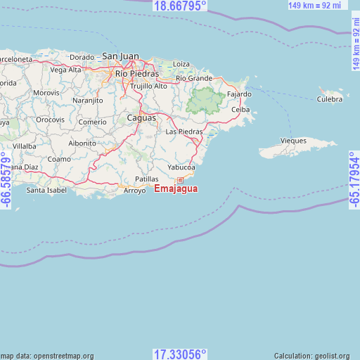
Emajagua GPS coordinates[2]
18° 0' 1.872" North, 65° 52' 57.576" West
| Map corner | latitude | longitude |
|---|---|---|
| Upper-left | 18.66795°, | -66.58579° |
| Center: | 18.00052°, | -65.88266° |
| Lower-right: | 17.33056°, | -65.17954° |
| Map W x H: | 148.7×148.7 km | = 92.4×92.4mi |
| max Lat: | 18.50078° ⇑89.3% North |
| Emajagua: | 18.00052° |
| min Lat: | ⇓10.7% South 17.95358° |
| min Long | Emajagua | max Long |
| -67.2499° | -65.88266° | -65.30099° |
| W 83.6%⇐ | ⇒16.4% E |
Elevation
Elevation of Emajagua is 22 m = 72 ft, and this is 78.5 m = 258 ft below average elevation for this country.
| Max E: |
655 m = 2149 ft | 68.4% |
| Avg. | 100.5 m = 330 ft | |
| Emajagua | 22 m = 72 ft | |
Min E: |
1 m = 3 ft | 31.6% |
See also: Puerto Rico elevation on elevation.city.
Geographical zone
Emajagua is located in North Torrid zone (between Equator and Tropic of Cancer). Distance of this Northern Tropic circle is 604.4 km =375.6 mi to North.| Distance of | km | miles | from Emajagua |
|---|---|---|---|
| North Pole | 8005.6 | 4974.4 | to North |
| Arctic Circle | 5399.7 | 3355.2 | to North |
| Tropic Cancer | 604.4 | 375.6 | to North |
| Equator | 2001.5 | 1243.7 | to South |


Nearby cities:
15 places around Emajagua: (largest is in red/bold)
• Buena Vista
17.9 km =11.1 mi,  268°
268°
• Candelero Arriba
12.3 km =7.6 mi,  23°
23°
• Comunas
10.5 km =6.5 mi, 23°
• El Negro
5.3 km =3.3 mi,  38°
38°
• Humacao
17.6 km =10.9 mi, 19°
• Lamboglia
11.1 km =6.9 mi,  258°
258°
• Martorell
8.6 km =5.3 mi,  348°
348°
• Maunabo
1.9 km =1.2 mi,  292°
292°
• Palmas
15.2 km =9.4 mi, 264°
• Palo Seco
5.8 km =3.6 mi,  277°
277°
• Patillas
14.1 km =8.8 mi, 272°
• Playita
5.6 km =3.5 mi,  331°
331°
• Rosa Sanchez
7.5 km =4.7 mi, 334°
• Yabucoa
5.6 km =3.5 mi,  3°
3°
• Yaurel
18.7 km =11.6 mi, 279°
Sources, notices
• [Note1] Compared only with cities in Puerto Rico existing in our database
• [Src1] Map data: © OpenStreetMap contributors (CC-BY-SA)
• [Src2] Other city data from geonames.org with taken over terms of usage.
• [Src3] Geographical zone / Annual Mean Temperature by Robert A. Rohde @ Wikipedia
