Martorell geodata
Martorell (Yabucoa) is a populated place; located in Puerto Rico in America/Puerto_Rico (GMT-4) time zone. With population of 2,884 people, there are 106 cities with bigger population in this country. Compared to other cities in Puerto Rico, 71.6% of cities are located further ↑North; 82.2% of cities are located further ←West and 65.3% of cities have higher elevation than Martorell. Note1


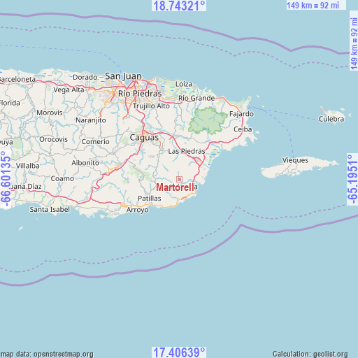
Martorell GPS coordinates[2]
18° 4' 33.852" North, 65° 53' 53.592" West
| Map corner | latitude | longitude |
|---|---|---|
| Upper-left | 18.74321°, | -66.60135° |
| Center: | 18.07607°, | -65.89822° |
| Lower-right: | 17.40639°, | -65.1951° |
| Map W x H: | 148.6×148.6 km | = 92.3×92.3mi |
| max Lat: | 18.50078° ⇑71.6% North |
| Martorell: | 18.07607° |
| min Lat: | ⇓28.4% South 17.95358° |
| min Long | Martorell | max Long |
| -67.2499° | -65.89822° | -65.30099° |
| W 82.2%⇐ | ⇒17.8% E |
Elevation
Elevation of Martorell is 27 m = 89 ft, and this is 73.5 m = 241 ft below average elevation for this country.
| Max E: |
655 m = 2149 ft | 65.3% |
| Avg. | 100.5 m = 330 ft | |
| Martorell | 27 m = 89 ft | |
Min E: |
1 m = 3 ft | 34.7% |
See also: Puerto Rico elevation on elevation.city.
Geographical zone
Martorell is located in North Torrid zone (between Equator and Tropic of Cancer). Distance of this Northern Tropic circle is 596 km =370.3 mi to North.| Distance of | km | miles | from Martorell |
|---|---|---|---|
| North Pole | 7997.2 | 4969.2 | to North |
| Arctic Circle | 5391.3 | 3350 | to North |
| Tropic Cancer | 596 | 370.3 | to North |
| Equator | 2009.9 | 1248.9 | to South |


Nearby cities:
15 places around Martorell: (largest is in red/bold)
• Candelero Arriba
7.1 km =4.4 mi,  66°
66°
• Comunas
5.9 km =3.7 mi,  77°
77°
• El Negro
6.6 km =4.1 mi,  130°
130°
• Emajagua
8.6 km =5.3 mi,  168°
168°
• Humacao
11.1 km =6.9 mi,  42°
42°
• Jagual
14 km =8.7 mi,  312°
312°
• La Fermina
12 km =7.5 mi,  23°
23°
• Lamboglia
14 km =8.7 mi,  221°
221°
• Las Piedras
12.4 km =7.7 mi, 15°
• Maunabo
7.7 km =4.8 mi,  180°
180°
• Palo Seco
8.7 km =5.4 mi,  208°
208°
• Playita
3.6 km =2.2 mi,  195°
195°
• Rosa Sanchez
2.3 km =1.4 mi,  225°
225°
• San Lorenzo
14.2 km =8.8 mi,  332°
332°
• Yabucoa
3.5 km =2.2 mi,  144°
144°
Sources, notices
• [Note1] Compared only with cities in Puerto Rico existing in our database
• [Src1] Map data: © OpenStreetMap contributors (CC-BY-SA)
• [Src2] Other city data from geonames.org with taken over terms of usage.
• [Src3] Geographical zone / Annual Mean Temperature by Robert A. Rohde @ Wikipedia
