Lares geodata
Lares is a seat of a first-order administrative division; located in Puerto Rico in America/Puerto_Rico (GMT-4) time zone. With population of 7,184 people, there are 47 cities with bigger population in this country. Compared to other cities in Puerto Rico, 57.3% of cities are located further ↓South; 80.4% of cities are located further →East and 91.6% of cities have lower elevation than Lares. Note1


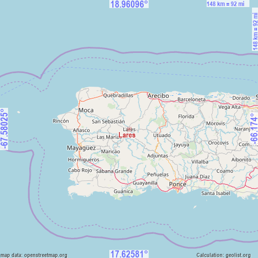
Lares GPS coordinates[2]
18° 17' 40.812" North, 66° 52' 37.632" West
| Map corner | latitude | longitude |
|---|---|---|
| Upper-left | 18.96096°, | -67.58025° |
| Center: | 18.29467°, | -66.87712° |
| Lower-right: | 17.62581°, | -66.174° |
| Map W x H: | 148.5×148.5 km | = 92.3×92.3mi |
| max Lat: | 18.50078° ⇑42.7% North |
| Lares: | 18.29467° |
| min Lat: | ⇓57.3% South 17.95358° |
| min Long | Lares | max Long |
| -67.2499° | -66.87712° | -65.30099° |
| W 19.6%⇐ | ⇒80.4% E |
Elevation
Elevation of Lares is 349 m = 1145 ft, and this is 248.5 m = 815 ft above average elevation for this country.
| Max E: |
655 m = 2149 ft | 8.4% |
| Lares | 349 m 1145 ft | |
| Avg. | 100.5 m = 330 ft | |
Min E: |
1 m = 3 ft | 91.6% |
See also: Puerto Rico elevation on elevation.city.
Geographical zone
Lares is located in North Torrid zone (between Equator and Tropic of Cancer). Distance of this Northern Tropic circle is 571.7 km =355.2 mi to North.| Distance of | km | miles | from Lares |
|---|---|---|---|
| North Pole | 7972.9 | 4954.1 | to North |
| Arctic Circle | 5367 | 3334.9 | to North |
| Tropic Cancer | 571.7 | 355.2 | to North |
| Equator | 2034.2 | 1264 | to South |


Nearby cities:
15 places around Lares: (largest is in red/bold)
• Cacao
17 km =10.6 mi,  338°
338°
• Cayuco
14.6 km =9.1 mi,  91°
91°
• Corcovado
21.1 km =13.1 mi,  30°
30°
• Hato Arriba
17.9 km =11.1 mi,  292°
292°
• Juncal
4.9 km =3 mi,  295°
295°
• Las Marías
13 km =8.1 mi,  248°
248°
• Maricao
16.7 km =10.4 mi,  220°
220°
• Piedra Gorda
15.5 km =9.6 mi,  355°
355°
• Quebrada
8.4 km =5.2 mi, 34°
• Quebradillas
20.9 km =13 mi, 341°
• Rafael Capo
16 km =9.9 mi,  38°
38°
• Rafael Gonzalez
17.6 km =10.9 mi, 32°
• San Antonio
19.1 km =11.9 mi, 336°
• San Sebastián
12.8 km =8 mi, 291°
• Utuado
18.9 km =11.7 mi,  99°
99°
Sources, notices
• [Note1] Compared only with cities in Puerto Rico existing in our database
• [Src1] Map data: © OpenStreetMap contributors (CC-BY-SA)
• [Src2] Other city data from geonames.org with taken over terms of usage.
• [Src3] Geographical zone / Annual Mean Temperature by Robert A. Rohde @ Wikipedia
