Unhais-o-Velho geodata
Unhais-o-Velho (Coimbra) is a populated place; located in Portugal in Europe/Lisbon (GMT+0) time zone. With population of 640 people, there are 804 cities with bigger population in this country. Compared to other cities in Portugal, 54.3% of cities are located further ↓South; 84.4% of cities are located further ←West and 97.2% of cities have lower elevation than Unhais-o-Velho. Note1


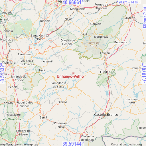
Unhais-o-Velho GPS coordinates[2]
40° 7' 52.14" North, 7° 48' 36.684" West
| Map corner | latitude | longitude |
|---|---|---|
| Upper-left | 40.66661°, | -8.51332° |
| Center: | 40.13115°, | -7.81019° |
| Lower-right: | 39.59144°, | -7.10707° |
| Map W x H: | 119.5×119.5 km | = 74.3×74.3mi |
| max Lat: | 42.11337° ⇑45.7% North |
| Unhais-o-Velho: | 40.13115° |
| min Lat: | ⇓54.3% South 32.6448° |
| min Long | Unhais-o-Velho | max Long |
| -31.17847° | -7.81019° | -6.27308° |
| W 84.4%⇐ | ⇒15.6% E |
Elevation
Elevation of Unhais-o-Velho is 701 m = 2300 ft, and this is 524 m = 1719 ft above average elevation for this country.
| Max E: |
1008 m = 3307 ft | 2.8% |
| Unhais-o-Velho | 701 m 2300 ft | |
| Avg. | 177 m = 581 ft | |
Min E: |
-128 m = -420 ft | 97.2% |
See also: Portugal elevation on elevation.city.
Geographical zone
Unhais-o-Velho is located in North temperate zone (between Tropic of Cancer and the Arctic Circle). Distance of this Northern Tropic circle is 1856.2 km =1153.4 mi to South.| Distance of | km | miles | from Unhais-o-Velho |
|---|---|---|---|
| North Pole | 5544.9 | 3445.4 | to North |
| Arctic Circle | 2939 | 1826.2 | to North |
| Tropic Cancer | 1856.2 | 1153.4 | to South |
| Equator | 4462.2 | 2772.7 | to South |


Nearby cities:
15 places around Unhais-o-Velho: (largest is in red/bold)
• Aldeia de Joanes
24.9 km =15.5 mi,  87°
87°
• Arganil
22.9 km =14.2 mi,  295°
295°
• Avô
19.6 km =12.2 mi,  336°
336°
• Barco
17.8 km =11.1 mi,  74°
74°
• Barroca Grande
5.8 km =3.6 mi,  64°
64°
• Fundão
26.3 km =16.3 mi, 87°
• Góis
25.7 km =16 mi,  276°
276°
• Loriga
23.9 km =14.9 mi,  25°
25°
• Oleiros
25.2 km =15.7 mi,  200°
200°
• Oliveira do Hospital
26 km =16.2 mi,  350°
350°
• Pampilhosa da Serra
15.3 km =9.5 mi,  231°
231°
• Santa Ovaia
21.3 km =13.2 mi, 342°
• São Jorge da Beira
5.9 km =3.7 mi,  43°
43°
• Vales do Rio
23.8 km =14.8 mi, 70°
• Vide
18.4 km =11.4 mi,  6°
6°
Sources, notices
• [Note1] Compared only with cities in Portugal existing in our database
• [Src1] Map data: © OpenStreetMap contributors (CC-BY-SA)
• [Src2] Other city data from geonames.org with taken over terms of usage.
• [Src3] Geographical zone / Annual Mean Temperature by Robert A. Rohde @ Wikipedia
