Arganil geodata
Arganil (Coimbra) is a seat of a second-order administrative division; located in Portugal in Europe/Lisbon (GMT+1) time zone. With population of 4,330 people, there are 491 cities with bigger population in this country. Compared to other cities in Portugal, 56.8% of cities are located further ↓South; 77.7% of cities are located further ←West and 64.5% of cities have lower elevation than Arganil. Note1


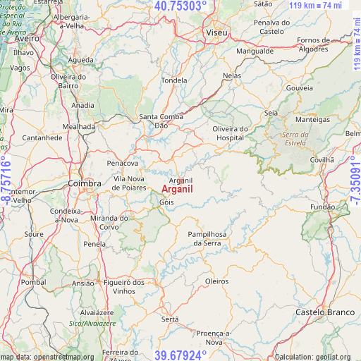
Arganil GPS coordinates[2]
40° 13' 5.736" North, 8° 3' 14.508" West
| Map corner | latitude | longitude |
|---|---|---|
| Upper-left | 40.75303°, | -8.75716° |
| Center: | 40.21826°, | -8.05403° |
| Lower-right: | 39.67924°, | -7.35091° |
| Map W x H: | 119.4×119.4 km | = 74.2×74.2mi |
| max Lat: | 42.11337° ⇑43.2% North |
| Arganil: | 40.21826° |
| min Lat: | ⇓56.8% South 32.6448° |
| min Long | Arganil | max Long |
| -31.17847° | -8.05403° | -6.27308° |
| W 77.7%⇐ | ⇒22.3% E |
Elevation
Elevation of Arganil is 175 m = 574 ft, and this is 2 m = 7 ft below average elevation for this country.
| Max E: |
1008 m = 3307 ft | 35.5% |
| Avg. | 177 m = 581 ft | |
| Arganil | 175 m = 574 ft | |
Min E: |
-128 m = -420 ft | 64.5% |
See also: Portugal elevation on elevation.city.
Geographical zone
Arganil is located in North temperate zone (between Tropic of Cancer and the Arctic Circle). Distance of this Northern Tropic circle is 1865.9 km =1159.4 mi to South.| Distance of | km | miles | from Arganil |
|---|---|---|---|
| North Pole | 5535.2 | 3439.4 | to North |
| Arctic Circle | 2929.3 | 1820.2 | to North |
| Tropic Cancer | 1865.9 | 1159.4 | to South |
| Equator | 4471.9 | 2778.7 | to South |


Nearby cities:
15 places around Arganil: (largest is in red/bold)
• Avô
15.3 km =9.5 mi,  57°
57°
• Friumes
15 km =9.3 mi,  293°
293°
• Góis
8.3 km =5.2 mi,  215°
215°
• Lousã
20.1 km =12.5 mi,  235°
235°
• Oliveira do Mondego
18.5 km =11.5 mi,  308°
308°
• Pampilhosa da Serra
21 km =13 mi,  155°
155°
• Penacova
20.2 km =12.6 mi, 286°
• Poiares
17.3 km =10.7 mi,  267°
267°
• Santa Comba Dão
21.1 km =13.1 mi,  341°
341°
• Santa Ovaia
17.8 km =11.1 mi,  53°
53°
• São João de Areias
18.8 km =11.7 mi,  356°
356°
• São Pedro de Alva
13.2 km =8.2 mi, 313°
• Travanca
16.3 km =10.1 mi,  316°
316°
• Tábua
16.1 km =10 mi,  7°
7°
• Vila Nova de Ceira
9.2 km =5.7 mi, 243°
Sources, notices
• [Note1] Compared only with cities in Portugal existing in our database
• [Src1] Map data: © OpenStreetMap contributors (CC-BY-SA)
• [Src2] Other city data from geonames.org with taken over terms of usage.
• [Src3] Geographical zone / Annual Mean Temperature by Robert A. Rohde @ Wikipedia
