Vide geodata
Vide (Guarda) is a populated place; located in Portugal in Europe/Lisbon (GMT+1) time zone. With population of 761 people, there are 788 cities with bigger population in this country. Compared to other cities in Portugal, 57.7% of cities are located further ↓South; 85.7% of cities are located further ←West and 81.2% of cities have lower elevation than Vide. Note1


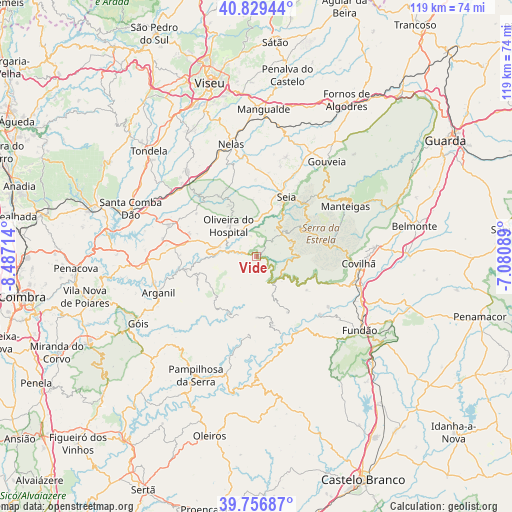
Vide GPS coordinates[2]
40° 17' 43.008" North, 7° 47' 2.436" West
| Map corner | latitude | longitude |
|---|---|---|
| Upper-left | 40.82944°, | -8.48714° |
| Center: | 40.29528°, | -7.78401° |
| Lower-right: | 39.75687°, | -7.08089° |
| Map W x H: | 119.3×119.3 km | = 74.1×74.1mi |
| max Lat: | 42.11337° ⇑42.3% North |
| Vide: | 40.29528° |
| min Lat: | ⇓57.7% South 32.6448° |
| min Long | Vide | max Long |
| -31.17847° | -7.78401° | -6.27308° |
| W 85.7%⇐ | ⇒14.3% E |
Elevation
Elevation of Vide is 298 m = 978 ft, and this is 121 m = 397 ft above average elevation for this country.
| Max E: |
1008 m = 3307 ft | 18.8% |
| Vide | 298 m 978 ft | |
| Avg. | 177 m = 581 ft | |
Min E: |
-128 m = -420 ft | 81.2% |
See also: Portugal elevation on elevation.city.
Geographical zone
Vide is located in North temperate zone (between Tropic of Cancer and the Arctic Circle). Distance of this Northern Tropic circle is 1874.5 km =1164.8 mi to South.| Distance of | km | miles | from Vide |
|---|---|---|---|
| North Pole | 5526.6 | 3434.1 | to North |
| Arctic Circle | 2920.8 | 1814.9 | to North |
| Tropic Cancer | 1874.5 | 1164.8 | to South |
| Equator | 4480.4 | 2784 | to South |


Nearby cities:
15 places around Vide: (largest is in red/bold)
• Avô
10.1 km =6.3 mi,  268°
268°
• Barco
20.1 km =12.5 mi,  132°
132°
• Barroca Grande
16 km =9.9 mi,  169°
169°
• Covilhã
23.7 km =14.7 mi,  93°
93°
• Lapa do Lobo
23.1 km =14.4 mi,  330°
330°
• Loriga
8.7 km =5.4 mi,  67°
67°
• Manteigas
23.9 km =14.9 mi,  59°
59°
• Oliveira do Hospital
9.8 km =6.1 mi,  318°
318°
• Santa Ovaia
8.8 km =5.5 mi,  283°
283°
• Seia
14.8 km =9.2 mi,  25°
25°
• São Jorge da Beira
14.1 km =8.8 mi, 172°
• São Romão
13.2 km =8.2 mi, 26°
• Tábua
22.1 km =13.7 mi,  289°
289°
• Unhais-o-Velho
18.4 km =11.4 mi,  186°
186°
• Vales do Rio
22.8 km =14.2 mi,  117°
117°
Sources, notices
• [Note1] Compared only with cities in Portugal existing in our database
• [Src1] Map data: © OpenStreetMap contributors (CC-BY-SA)
• [Src2] Other city data from geonames.org with taken over terms of usage.
• [Src3] Geographical zone / Annual Mean Temperature by Robert A. Rohde @ Wikipedia
