Travanca geodata
Travanca (Coimbra) is a populated place; located in Portugal in Europe/Lisbon (GMT+1) time zone. With population of 1,079 people, there are 739 cities with bigger population in this country. Compared to other cities in Portugal, 58.4% of cities are located further ↓South; 73.6% of cities are located further ←West and 68.7% of cities have lower elevation than Travanca. Note1


Travanca GPS coordinates[2]
40° 19' 24.852" North, 8° 11' 12.732" West
| Map corner | latitude | longitude |
|---|---|---|
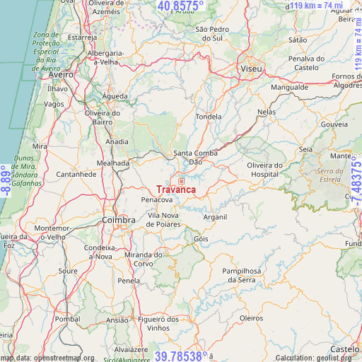
| Upper-left | 40.8575°, | -8.89° |
| Center: | 40.32357°, | -8.18687° |
| Lower-right: | 39.78538°, | -7.48375° |
| Map W x H: | 119.2×119.2 km | = 74.1×74.1mi |
| max Lat: | 42.11337° ⇑41.6% North |
| Travanca: | 40.32357° |
| min Lat: | ⇓58.4% South 32.6448° |
| min Long | Travanca | max Long |
| -31.17847° | -8.18687° | -6.27308° |
| W 73.6%⇐ | ⇒26.4% E |
Elevation
Elevation of Travanca is 194 m = 636 ft, and this is 17 m = 56 ft above average elevation for this country.
| Max E: |
1008 m = 3307 ft | 31.3% |
| Travanca | 194 m 636 ft | |
| Avg. | 177 m = 581 ft | |
Min E: |
-128 m = -420 ft | 68.7% |
See also: Portugal elevation on elevation.city.
Geographical zone
Travanca is located in North temperate zone (between Tropic of Cancer and the Arctic Circle). Distance of this Northern Tropic circle is 1877.6 km =1166.7 mi to South.| Distance of | km | miles | from Travanca |
|---|---|---|---|
| North Pole | 5523.5 | 3432.1 | to North |
| Arctic Circle | 2917.6 | 1812.9 | to North |
| Tropic Cancer | 1877.6 | 1166.7 | to South |
| Equator | 4483.6 | 2786 | to South |


Nearby cities:
15 places around Travanca: (largest is in red/bold)
• Arganil
16.3 km =10.1 mi,  136°
136°
• Friumes
6.2 km =3.9 mi,  203°
203°
• Góis
19.6 km =12.2 mi,  160°
160°
• Lorvão
13.1 km =8.1 mi,  237°
237°
• Luso
17.6 km =10.9 mi,  292°
292°
• Mortágua
9 km =5.6 mi,  334°
334°
• Oliveira do Mondego
3.1 km =1.9 mi,  268°
268°
• Penacova
10.1 km =6.3 mi,  233°
233°
• Poiares
13.9 km =8.6 mi,  205°
205°
• Santa Comba Dão
9.6 km =6 mi,  29°
29°
• São João de Areias
12.3 km =7.6 mi,  54°
54°
• São Pedro de Alva
3.1 km =1.9 mi,  145°
145°
• Treixedo
14.4 km =8.9 mi, 32°
• Tábua
14 km =8.7 mi,  72°
72°
• Vila Nova de Ceira
16.1 km =10 mi,  169°
169°
Sources, notices
• [Note1] Compared only with cities in Portugal existing in our database
• [Src1] Map data: © OpenStreetMap contributors (CC-BY-SA)
• [Src2] Other city data from geonames.org with taken over terms of usage.
• [Src3] Geographical zone / Annual Mean Temperature by Robert A. Rohde @ Wikipedia
