Riđica geodata
Riđica (Vojvodina) is a populated place; located in Serbia in Europe/Belgrade (GMT+2) time zone. With population of 3,186 people, there are 142 cities with bigger population in this country. Compared to other cities in Serbia, 98.9% of cities are located further ↓South; 98.4% of cities are located further →East and 53.3% of cities have lower elevation than Riđica. Note1


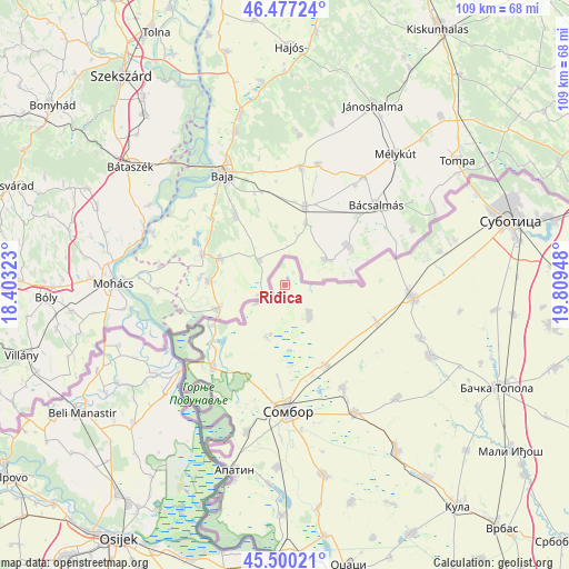
Riđica GPS coordinates[2]
45° 59' 27.168" North, 19° 6' 22.86" East
| Map corner | latitude | longitude |
|---|---|---|
| Upper-left | 46.47724°, | 18.40323° |
| Center: | 45.99088°, | 19.10635° |
| Lower-right: | 45.50021°, | 19.80948° |
| Map W x H: | 108.6×108.6 km | = 67.5×67.5mi |
| max Lat: | 46.1° ⇑1.1% North |
| Riđica: | 45.99088° |
| min Lat: | ⇓98.9% South 42.25846° |
| min Long | Riđica | max Long |
| 18.9276° | 19.10635° | 22.77556° |
| W 1.6%⇐ | ⇒98.4% E |
Elevation
Elevation of Riđica is 94 m = 308 ft, and this is 82.4 m = 270 ft below average elevation for this country.
| Max E: |
1421 m = 4662 ft | 46.7% |
| Avg. | 176.4 m = 579 ft | |
| Riđica | 94 m = 308 ft | |
Min E: |
49 m = 161 ft | 53.3% |
See also: Serbia elevation on elevation.city.
Geographical zone
Riđica is located in North temperate zone (between Tropic of Cancer and the Arctic Circle). Distance of this North polar circle is 2287.5 km =1421.4 mi to North.| Distance of | km | miles | from Riđica |
|---|---|---|---|
| North Pole | 4893.4 | 3040.6 | to North |
| Arctic Circle | 2287.5 | 1421.4 | to North |
| Tropic Cancer | 2507.8 | 1558.3 | to South |
| Equator | 5113.7 | 3177.5 | to South |


Nearby cities:
15 places around Riđica: (largest is in red/bold)
• Apatin
36.8 km =22.9 mi,  195°
195°
• Bačka Topola
45.1 km =28 mi,  115°
115°
• Bački Breg
15.8 km =9.8 mi,  240°
240°
• Bogojevo
51.3 km =31.9 mi,  177°
177°
• Doroslovo
43.2 km =26.8 mi,  171°
171°
• Gakovo
10.6 km =6.6 mi, 199°
• Kolut
17.6 km =10.9 mi,  231°
231°
• Kula
53.5 km =33.2 mi,  142°
142°
• Kupusina
29.1 km =18.1 mi,  194°
194°
• Mali Iđoš
53.5 km =33.2 mi,  125°
125°
• Prigrevica
35 km =21.7 mi, 182°
• Sombor
24.1 km =15 mi, 178°
• Sonta
44.1 km =27.4 mi, 180°
• Stanišić
7.4 km =4.6 mi, 140°
• Subotica
44.9 km =27.9 mi,  74°
74°
Sources, notices
• [Note1] Compared only with cities in Serbia existing in our database
• [Src1] Map data: © OpenStreetMap contributors (CC-BY-SA)
• [Src2] Other city data from geonames.org with taken over terms of usage.
• [Src3] Geographical zone / Annual Mean Temperature by Robert A. Rohde @ Wikipedia
