Zlatibor geodata
Zlatibor (Central Serbia) is a populated place; located in Serbia in Europe/Belgrade (GMT+2) time zone. With population of 2,344 people, there are 188 cities with bigger population in this country. Compared to other cities in Serbia, 83.9% of cities are located further ↑North; 78% of cities are located further →East and 98.2% of cities have lower elevation than Zlatibor. Note1


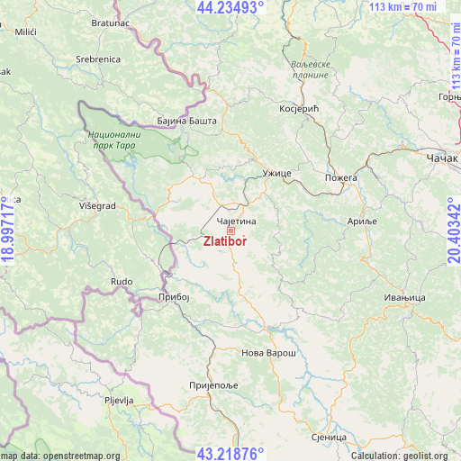
Zlatibor GPS coordinates[2]
43° 43' 44.4" North, 19° 42' 1.044" East
| Map corner | latitude | longitude |
|---|---|---|
| Upper-left | 44.23493°, | 18.99717° |
| Center: | 43.729°, | 19.70029° |
| Lower-right: | 43.21876°, | 20.40342° |
| Map W x H: | 113×113 km | = 70.2×70.2mi |
| max Lat: | 46.1° ⇑83.9% North |
| Zlatibor: | 43.729° |
| min Lat: | ⇓16.1% South 42.25846° |
| min Long | Zlatibor | max Long |
| 18.9276° | 19.70029° | 22.77556° |
| W 22%⇐ | ⇒78% E |
Elevation
Elevation of Zlatibor is 980 m = 3215 ft, and this is 803.6 m = 2636 ft above average elevation for this country.
| Max E: |
1421 m = 4662 ft | 1.8% |
| Zlatibor | 980 m 3215 ft | |
| Avg. | 176.4 m = 579 ft | |
Min E: |
49 m = 161 ft | 98.2% |
See also: Serbia elevation on elevation.city.
Geographical zone
Zlatibor is located in North temperate zone (between Tropic of Cancer and the Arctic Circle). Distance of this Northern Tropic circle is 2256.3 km =1402 mi to South.| Distance of | km | miles | from Zlatibor |
|---|---|---|---|
| North Pole | 5144.9 | 3196.9 | to North |
| Arctic Circle | 2539 | 1577.7 | to North |
| Tropic Cancer | 2256.3 | 1402 | to South |
| Equator | 4862.2 | 3021.2 | to South |


Nearby cities:
15 places around Zlatibor: (largest is in red/bold)
• Arilje
31.9 km =19.8 mi,  85°
85°
• Bajina Bašta
28.9 km =18 mi,  338°
338°
• Ivanjica
45.8 km =28.5 mi,  111°
111°
• Kosjerić
34 km =21.1 mi,  29°
29°
• Lučani
38.1 km =23.7 mi,  67°
67°
• Mokra Gora
17.4 km =10.8 mi,  292°
292°
• Nova Varoš
31.2 km =19.4 mi,  163°
163°
• Požega
30.1 km =18.7 mi,  63°
63°
• Priboj
21.5 km =13.4 mi,  220°
220°
• Prijepolje
37.9 km =23.5 mi,  186°
186°
• Sjenica
56.1 km =34.9 mi,  154°
154°
• Užice
18.7 km =11.6 mi,  39°
39°
• Ðurići
25.5 km =15.8 mi, 294°
• Čajetina
2.5 km =1.6 mi,  23°
23°
• Čačak
55.1 km =34.2 mi, 70°
Sources, notices
• [Note1] Compared only with cities in Serbia existing in our database
• [Src1] Map data: © OpenStreetMap contributors (CC-BY-SA)
• [Src2] Other city data from geonames.org with taken over terms of usage.
• [Src3] Geographical zone / Annual Mean Temperature by Robert A. Rohde @ Wikipedia
