Majdanpek geodata
Majdanpek (Central Serbia) is a seat of a third-order administrative division; located in Serbia in Europe/Belgrade (GMT+2) time zone. With population of 10,071 people, there are 55 cities with bigger population in this country. Compared to other cities in Serbia, 72.8% of cities are located further ↑North; 94.3% of cities are located further ←West and 95.2% of cities have lower elevation than Majdanpek. Note1


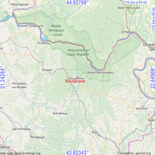
Majdanpek GPS coordinates[2]
44° 25' 39.756" North, 21° 56' 45.456" East
| Map corner | latitude | longitude |
|---|---|---|
| Upper-left | 44.92768°, | 21.24284° |
| Center: | 44.42771°, | 21.94596° |
| Lower-right: | 43.92343°, | 22.64909° |
| Map W x H: | 111.7×111.7 km | = 69.4×69.4mi |
| max Lat: | 46.1° ⇑72.8% North |
| Majdanpek: | 44.42771° |
| min Lat: | ⇓27.2% South 42.25846° |
| min Long | Majdanpek | max Long |
| 18.9276° | 21.94596° | 22.77556° |
| W 94.3%⇐ | ⇒5.7% E |
Elevation
Elevation of Majdanpek is 504 m = 1654 ft, and this is 327.6 m = 1075 ft above average elevation for this country.
| Max E: |
1421 m = 4662 ft | 4.8% |
| Majdanpek | 504 m 1654 ft | |
| Avg. | 176.4 m = 579 ft | |
Min E: |
49 m = 161 ft | 95.2% |
See also: Serbia elevation on elevation.city.
Geographical zone
Majdanpek is located in North temperate zone (between Tropic of Cancer and the Arctic Circle). Distance of this Northern Tropic circle is 2334 km =1450.3 mi to South.| Distance of | km | miles | from Majdanpek |
|---|---|---|---|
| North Pole | 5067.2 | 3148.6 | to North |
| Arctic Circle | 2461.3 | 1529.4 | to North |
| Tropic Cancer | 2334 | 1450.3 | to South |
| Equator | 4939.9 | 3069.5 | to South |


Nearby cities:
15 places around Majdanpek: (largest is in red/bold)
• Bor
41 km =25.5 mi,  163°
163°
• Despotovac
54.5 km =33.9 mi,  226°
226°
• Donji Milanovac
16.9 km =10.5 mi,  75°
75°
• Duboka
18.1 km =11.2 mi,  305°
305°
• Golubac
35.3 km =21.9 mi,  315°
315°
• Kladovo
56.4 km =35 mi,  68°
68°
• Kučevo
22.6 km =14 mi,  284°
284°
• Malo Crniće
54.3 km =33.7 mi,  285°
285°
• Negotin
51.6 km =32.1 mi,  115°
115°
• Petrovac
42.2 km =26.2 mi,  262°
262°
• Radenka
22.5 km =14 mi, 320°
• Turija
26.5 km =16.5 mi, 293°
• Veliko Gradište
50.5 km =31.4 mi, 317°
• Ševica
19.9 km =12.4 mi,  297°
297°
• Žagubica
28.6 km =17.8 mi,  206°
206°
Sources, notices
• [Note1] Compared only with cities in Serbia existing in our database
• [Src1] Map data: © OpenStreetMap contributors (CC-BY-SA)
• [Src2] Other city data from geonames.org with taken over terms of usage.
• [Src3] Geographical zone / Annual Mean Temperature by Robert A. Rohde @ Wikipedia
