Negotin geodata
Negotin (Central Serbia) is a seat of a third-order administrative division; located in Serbia in Europe/Belgrade (GMT+2) time zone. With population of 17,612 people, there are 43 cities with bigger population in this country. Compared to other cities in Serbia, 77.1% of cities are located further ↑North; 99.3% of cities are located further ←West and 100% of cities have higher elevation than Negotin. Note1


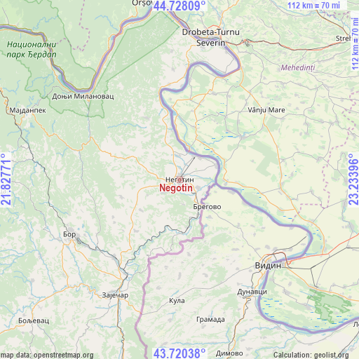
Negotin GPS coordinates[2]
44° 13' 35.004" North, 22° 31' 50.988" East
| Map corner | latitude | longitude |
|---|---|---|
| Upper-left | 44.72809°, | 21.82771° |
| Center: | 44.22639°, | 22.53083° |
| Lower-right: | 43.72038°, | 23.23396° |
| Map W x H: | 112×112 km | = 69.6×69.6mi |
| max Lat: | 46.1° ⇑77.1% North |
| Negotin: | 44.22639° |
| min Lat: | ⇓22.9% South 42.25846° |
| min Long | Negotin | max Long |
| 18.9276° | 22.53083° | 22.77556° |
| W 99.3%⇐ | ⇒0.7% E |
Elevation
Elevation of Negotin is 49 m = 161 ft, and this is 127.4 m = 418 ft below average elevation for this country.
| Max E: |
1421 m = 4662 ft | 100% |
| Avg. | 176.4 m = 579 ft | |
| Negotin | 49 m = 161 ft | |
Min E: |
49 m = 161 ft | 0% |
See also: Serbia elevation on elevation.city.
Geographical zone
Negotin is located in North temperate zone (between Tropic of Cancer and the Arctic Circle). Distance of this Northern Tropic circle is 2311.6 km =1436.4 mi to South.| Distance of | km | miles | from Negotin |
|---|---|---|---|
| North Pole | 5089.5 | 3162.5 | to North |
| Arctic Circle | 2483.7 | 1543.3 | to North |
| Tropic Cancer | 2311.6 | 1436.4 | to South |
| Equator | 4917.5 | 3055.6 | to South |


Nearby cities:
15 places around Negotin: (largest is in red/bold)
• Boljevac
63.8 km =39.6 mi,  226°
226°
• Bor
38.6 km =24 mi,  244°
244°
• Donji Milanovac
40.2 km =25 mi,  311°
311°
• Duboka
69.5 km =43.2 mi,  298°
298°
• Golubac
85.7 km =53.3 mi, 303°
• Kladovo
43.3 km =26.9 mi,  8°
8°
• Knjazevac
76.6 km =47.6 mi,  196°
196°
• Kučevo
73.9 km =45.9 mi,  292°
292°
• Majdanpek
51.6 km =32.1 mi, 295°
• Radenka
72.7 km =45.2 mi, 303°
• Soko Banja
83.6 km =51.9 mi,  219°
219°
• Turija
78.1 km =48.5 mi, 294°
• Zaječar
41.7 km =25.9 mi,  210°
210°
• Ševica
71.5 km =44.4 mi, 296°
• Žagubica
59.3 km =36.8 mi,  266°
266°
Sources, notices
• [Note1] Compared only with cities in Serbia existing in our database
• [Src1] Map data: © OpenStreetMap contributors (CC-BY-SA)
• [Src2] Other city data from geonames.org with taken over terms of usage.
• [Src3] Geographical zone / Annual Mean Temperature by Robert A. Rohde @ Wikipedia
