Yelantsy geodata
Yelantsy (Irkutsk Oblast) is a populated place; located in Russia in Asia/Irkutsk (GMT+8) time zone. With population of 4,009 people, there are 3106 cities with bigger population in this country. Compared to other cities in Russia, 64% of cities are located further ↑North; 90.1% of cities are located further ←West and 91.3% of cities have lower elevation than Yelantsy. Note1


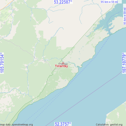
Yelantsy GPS coordinates[2]
52° 48' 10.296" North, 106° 24' 16.776" East
| Map corner | latitude | longitude |
|---|---|---|
| Upper-left | 53.22587°, | 105.70154° |
| Center: | 52.80286°, | 106.40466° |
| Lower-right: | 52.3757°, | 107.10779° |
| Map W x H: | 94.5×94.5 km | = 58.7×58.7mi |
| max Lat: | 73.50819° ⇑64% North |
| Yelantsy: | 52.80286° |
| min Lat: | ⇓36% South 41.28413° |
| min Long | Yelantsy | max Long |
| -179.12198° | 106.40466° | 179.35046° |
| W 90.1%⇐ | ⇒9.9% E |
Elevation
Elevation of Yelantsy is 483 m = 1585 ft, and this is 280.4 m = 920 ft above average elevation for this country.
| Max E: |
2518 m = 8261 ft | 8.7% |
| Yelantsy | 483 m 1585 ft | |
| Avg. | 202.6 m = 665 ft | |
Min E: |
-28 m = -92 ft | 91.3% |
See also: Russia elevation on elevation.city.
Geographical zone
Yelantsy is located in North temperate zone (between Tropic of Cancer and the Arctic Circle). Distance of this North polar circle is 1530 km =950.7 mi to North.| Distance of | km | miles | from Yelantsy |
|---|---|---|---|
| North Pole | 4135.9 | 2569.9 | to North |
| Arctic Circle | 1530 | 950.7 | to North |
| Tropic Cancer | 3265.2 | 2028.9 | to South |
| Equator | 5871.1 | 3648.1 | to South |


Nearby cities:
15 places around Yelantsy: (largest is in red/bold)
• Bayanday
66.5 km =41.3 mi,  296°
296°
• Biryul’ka
118.5 km =73.6 mi,  357°
357°
• Bol’shoye Goloustnoye
108.5 km =67.4 mi,  218°
218°
• Bugul’deyka
36.3 km =22.6 mi, 218°
• Il’inka
96 km =59.7 mi,  142°
142°
• Istok
79.4 km =49.3 mi,  187°
187°
• Kabansk
85.5 km =53.1 mi,  168°
168°
• Khuzhir
76.2 km =47.3 mi,  55°
55°
• Manzurka
79.4 km =49.3 mi,  342°
342°
• Posol’skoye
88.3 km =54.9 mi, 190°
• Sotnikovo
125.6 km =78 mi, 144°
• Tataurovo
101.6 km =63.1 mi, 136°
• Turka
123 km =76.4 mi,  82°
82°
• Turuntayevo
107.3 km =66.7 mi,  128°
128°
• Ust’-Ordynskiy
111.2 km =69.1 mi,  270°
270°
Sources, notices
• [Note1] Compared only with cities in Russia existing in our database
• [Src1] Map data: © OpenStreetMap contributors (CC-BY-SA)
• [Src2] Other city data from geonames.org with taken over terms of usage.
• [Src3] Geographical zone / Annual Mean Temperature by Robert A. Rohde @ Wikipedia
