Abagaytuy geodata
Abagaytuy (Transbaikal Territory) is a populated place; located in Russia in Asia/Chita (GMT+9) time zone. With population of 564 people, there are 4923 cities with bigger population in this country. Compared to other cities in Russia, 78.5% of cities are located further ↑North; 92.7% of cities are located further ←West and 93.4% of cities have lower elevation than Abagaytuy. Note1


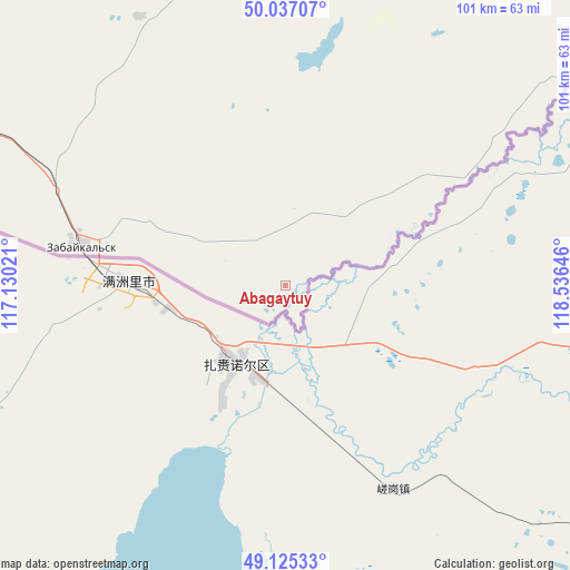
Abagaytuy GPS coordinates[2]
49° 34' 59.988" North, 117° 49' 59.988" East
| Map corner | latitude | longitude |
|---|---|---|
| Upper-left | 50.03707°, | 117.13021° |
| Center: | 49.58333°, | 117.83333° |
| Lower-right: | 49.12533°, | 118.53646° |
| Map W x H: | 101.4×101.4 km | = 63×63mi |
| max Lat: | 73.50819° ⇑78.5% North |
| Abagaytuy: | 49.58333° |
| min Lat: | ⇓21.5% South 41.28413° |
| min Long | Abagaytuy | max Long |
| -179.12198° | 117.83333° | 179.35046° |
| W 92.7%⇐ | ⇒7.3% E |
Elevation
Elevation of Abagaytuy is 554 m = 1818 ft, and this is 351.4 m = 1153 ft above average elevation for this country.
| Max E: |
2518 m = 8261 ft | 6.6% |
| Abagaytuy | 554 m 1818 ft | |
| Avg. | 202.6 m = 665 ft | |
Min E: |
-28 m = -92 ft | 93.4% |
See also: Russia elevation on elevation.city.
Geographical zone
Abagaytuy is located in North temperate zone (between Tropic of Cancer and the Arctic Circle). Distance of this North polar circle is 1888 km =1173.1 mi to North.| Distance of | km | miles | from Abagaytuy |
|---|---|---|---|
| North Pole | 4493.9 | 2792.4 | to North |
| Arctic Circle | 1888 | 1173.1 | to North |
| Tropic Cancer | 2907.2 | 1806.4 | to South |
| Equator | 5513.1 | 3425.7 | to South |


Nearby cities:
15 places around Abagaytuy: (largest is in red/bold)
• Aleksandrovskiy Zavod
149.4 km =92.8 mi,  2°
2°
• Borzya
129.5 km =80.5 mi,  313°
313°
• Dauriya
79.6 km =49.5 mi,  299°
299°
• Gazimurskiy Zavod
222 km =137.9 mi,  9°
9°
• Kadaya
182.5 km =113.4 mi,  34°
34°
• Kalanguy
184.8 km =114.8 mi,  329°
329°
• Kalga
167.4 km =104 mi, 26°
• Klichka
96.6 km =60 mi, 6°
• Krasnokamensk
59 km =36.7 mi, 14°
• Nerchinskiy Zavod
229.6 km =142.7 mi, 33°
• Nizhniy Tsasuchey
218.9 km =136 mi, 298°
• Olovyannaya
221.4 km =137.6 mi, 313°
• Priargunsk
125.9 km =78.2 mi,  46°
46°
• Vershino-Shakhtaminskiy
190.9 km =118.6 mi, 1°
• Zabaykal’sk
37.4 km =23.2 mi,  281°
281°
Sources, notices
• [Note1] Compared only with cities in Russia existing in our database
• [Src1] Map data: © OpenStreetMap contributors (CC-BY-SA)
• [Src2] Other city data from geonames.org with taken over terms of usage.
• [Src3] Geographical zone / Annual Mean Temperature by Robert A. Rohde @ Wikipedia
