Priargunsk geodata
Priargunsk (Transbaikal Territory) is a populated place; located in Russia in Asia/Chita (GMT+9) time zone. With population of 7,902 people, there are 1829 cities with bigger population in this country. Compared to other cities in Russia, 77.1% of cities are located further ↑North; 92.9% of cities are located further ←West and 92.5% of cities have lower elevation than Priargunsk. Note1


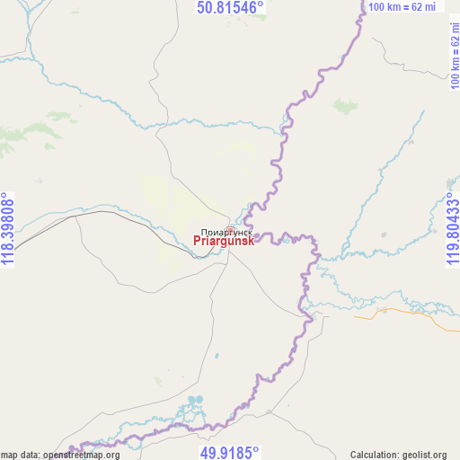
Priargunsk GPS coordinates[2]
50° 22' 8.76" North, 119° 6' 4.32" East
| Map corner | latitude | longitude |
|---|---|---|
| Upper-left | 50.81546°, | 118.39808° |
| Center: | 50.3691°, | 119.1012° |
| Lower-right: | 49.9185°, | 119.80433° |
| Map W x H: | 99.7×99.7 km | = 62×62mi |
| max Lat: | 73.50819° ⇑77.1% North |
| Priargunsk: | 50.3691° |
| min Lat: | ⇓22.9% South 41.28413° |
| min Long | Priargunsk | max Long |
| -179.12198° | 119.1012° | 179.35046° |
| W 92.9%⇐ | ⇒7.1% E |
Elevation
Elevation of Priargunsk is 522 m = 1713 ft, and this is 319.4 m = 1048 ft above average elevation for this country.
| Max E: |
2518 m = 8261 ft | 7.5% |
| Priargunsk | 522 m 1713 ft | |
| Avg. | 202.6 m = 665 ft | |
Min E: |
-28 m = -92 ft | 92.5% |
See also: Russia elevation on elevation.city.
Geographical zone
Priargunsk is located in North temperate zone (between Tropic of Cancer and the Arctic Circle). Distance of this North polar circle is 1800.7 km =1118.9 mi to North.| Distance of | km | miles | from Priargunsk |
|---|---|---|---|
| North Pole | 4406.5 | 2738.1 | to North |
| Arctic Circle | 1800.7 | 1118.9 | to North |
| Tropic Cancer | 2994.6 | 1860.8 | to South |
| Equator | 5600.5 | 3480 | to South |


Nearby cities:
15 places around Priargunsk: (largest is in red/bold)
• Abagaytuy
125.9 km =78.2 mi,  226°
226°
• Aleksandrovskiy Zavod
102.7 km =63.8 mi,  307°
307°
• Baley
219.1 km =136.1 mi, 307°
• Borzya
183.3 km =113.9 mi,  270°
270°
• Dauriya
166.4 km =103.4 mi,  253°
253°
• Gazimurskiy Zavod
142 km =88.2 mi,  338°
338°
• Kadaya
64.1 km =39.8 mi,  12°
12°
• Kalanguy
195.8 km =121.7 mi,  291°
291°
• Kalga
63.5 km =39.5 mi,  347°
347°
• Klichka
78.8 km =49 mi,  276°
276°
• Krasnokamensk
81.5 km =50.6 mi, 248°
• Nerchinskiy Zavod
110.5 km =68.7 mi,  19°
19°
• Shelopugino
178.7 km =111 mi,  322°
322°
• Vershino-Shakhtaminskiy
134.1 km =83.3 mi, 320°
• Zabaykal’sk
149.9 km =93.1 mi,  237°
237°
Sources, notices
• [Note1] Compared only with cities in Russia existing in our database
• [Src1] Map data: © OpenStreetMap contributors (CC-BY-SA)
• [Src2] Other city data from geonames.org with taken over terms of usage.
• [Src3] Geographical zone / Annual Mean Temperature by Robert A. Rohde @ Wikipedia
