Krasnokamensk geodata
Krasnokamensk (Transbaikal Territory) is a populated place; located in Russia in Asia/Chita (GMT+9) time zone. With population of 54,316 people, there are 387 cities with bigger population in this country. Compared to other cities in Russia, 77.8% of cities are located further ↑North; 92.8% of cities are located further ←West and 95.1% of cities have lower elevation than Krasnokamensk. Note1


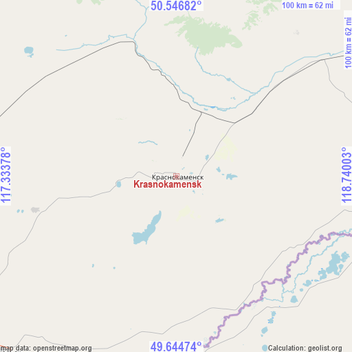
Krasnokamensk GPS coordinates[2]
50° 5' 52.44" North, 118° 2' 12.84" East
| Map corner | latitude | longitude |
|---|---|---|
| Upper-left | 50.54682°, | 117.33378° |
| Center: | 50.0979°, | 118.0369° |
| Lower-right: | 49.64474°, | 118.74003° |
| Map W x H: | 100.3×100.3 km | = 62.3×62.3mi |
| max Lat: | 73.50819° ⇑77.8% North |
| Krasnokamensk: | 50.0979° |
| min Lat: | ⇓22.2% South 41.28413° |
| min Long | Krasnokamensk | max Long |
| -179.12198° | 118.0369° | 179.35046° |
| W 92.8%⇐ | ⇒7.2% E |
Elevation
Elevation of Krasnokamensk is 642 m = 2106 ft, and this is 439.4 m = 1442 ft above average elevation for this country.
| Max E: |
2518 m = 8261 ft | 4.9% |
| Krasnokamensk | 642 m 2106 ft | |
| Avg. | 202.6 m = 665 ft | |
Min E: |
-28 m = -92 ft | 95.1% |
See also: Krasnokamensk elevation on elevation.city.
Geographical zone
Krasnokamensk is located in North temperate zone (between Tropic of Cancer and the Arctic Circle). Distance of this North polar circle is 1830.8 km =1137.6 mi to North.| Distance of | km | miles | from Krasnokamensk |
|---|---|---|---|
| North Pole | 4436.7 | 2756.8 | to North |
| Arctic Circle | 1830.8 | 1137.6 | to North |
| Tropic Cancer | 2964.4 | 1842 | to South |
| Equator | 5570.4 | 3461.3 | to South |


Nearby cities:
15 places around Krasnokamensk: (largest is in red/bold)
• Abagaytuy
59 km =36.7 mi,  194°
194°
• Aleksandrovskiy Zavod
92.3 km =57.4 mi,  355°
355°
• Baley
192.1 km =119.4 mi,  329°
329°
• Borzya
112.7 km =70 mi,  286°
286°
• Dauriya
85.6 km =53.2 mi,  257°
257°
• Gazimurskiy Zavod
163.3 km =101.5 mi,  7°
7°
• Kadaya
128.5 km =79.8 mi,  43°
43°
• Kalanguy
148.2 km =92.1 mi,  313°
313°
• Kalga
110.4 km =68.6 mi,  33°
33°
• Klichka
38.8 km =24.1 mi, 355°
• Nerchinskiy Zavod
174.6 km =108.5 mi, 39°
• Priargunsk
81.5 km =50.6 mi,  68°
68°
• Shelopugino
176.1 km =109.4 mi,  349°
349°
• Vershino-Shakhtaminskiy
134.1 km =83.3 mi, 355°
• Zabaykal’sk
71.2 km =44.2 mi,  225°
225°
Sources, notices
• [Note1] Compared only with cities in Russia existing in our database
• [Src1] Map data: © OpenStreetMap contributors (CC-BY-SA)
• [Src2] Other city data from geonames.org with taken over terms of usage.
• [Src3] Geographical zone / Annual Mean Temperature by Robert A. Rohde @ Wikipedia
