Vershino-Darasunskiy geodata
Vershino-Darasunskiy (Transbaikal Territory) is a populated place; located in Russia in Asia/Chita (GMT+9) time zone. With population of 6,451 people, there are 2140 cities with bigger population in this country. Compared to other cities in Russia, 67% of cities are located further ↑North; 92.3% of cities are located further ←West and 97.7% of cities have lower elevation than Vershino-Darasunskiy. Note1


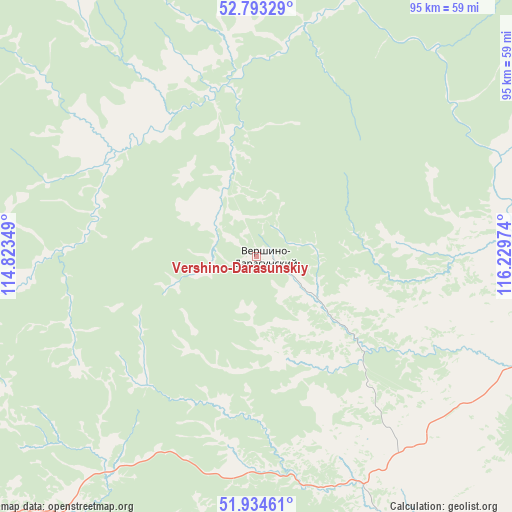
Vershino-Darasunskiy GPS coordinates[2]
52° 21' 57.744" North, 115° 31' 35.796" East
| Map corner | latitude | longitude |
|---|---|---|
| Upper-left | 52.79329°, | 114.82349° |
| Center: | 52.36604°, | 115.52661° |
| Lower-right: | 51.93461°, | 116.22974° |
| Map W x H: | 95.5×95.5 km | = 59.3×59.3mi |
| max Lat: | 73.50819° ⇑67% North |
| Vershino-Darasunskiy: | 52.36604° |
| min Lat: | ⇓33% South 41.28413° |
| min Long | Vershino-Darasu | max Long |
| -179.12198° | 115.52661° | 179.35046° |
| W 92.3%⇐ | ⇒7.7% E |
Elevation
Elevation of Vershino-Darasunskiy is 842 m = 2762 ft, and this is 639.4 m = 2098 ft above average elevation for this country.
| Max E: |
2518 m = 8261 ft | 2.3% |
| Vershino-Darasunskiy | 842 m 2762 ft | |
| Avg. | 202.6 m = 665 ft | |
Min E: |
-28 m = -92 ft | 97.7% |
See also: Russia elevation on elevation.city.
Geographical zone
Vershino-Darasunskiy is located in North temperate zone (between Tropic of Cancer and the Arctic Circle). Distance of this North polar circle is 1578.6 km =980.9 mi to North.| Distance of | km | miles | from Vershino-Darasunskiy |
|---|---|---|---|
| North Pole | 4184.5 | 2600.1 | to North |
| Arctic Circle | 1578.6 | 980.9 | to North |
| Tropic Cancer | 3216.6 | 1998.7 | to South |
| Equator | 5822.6 | 3618 | to South |


Nearby cities:
15 places around Vershino-Darasunskiy: (largest is in red/bold)
• Arbagar
68.9 km =42.8 mi,  134°
134°
• Baley
115.6 km =71.8 mi,  138°
138°
• Bol’shaya Tura
127.8 km =79.4 mi,  229°
229°
• Bukachacha
116.2 km =72.2 mi,  53°
53°
• Chernyshevsk
102.5 km =63.7 mi,  80°
80°
• Karymskoye
115.9 km =72 mi,  224°
224°
• Kholbon
72.9 km =45.3 mi, 137°
• Makkaveyevo
127.8 km =79.4 mi,  237°
237°
• Mogoytuy
127.5 km =79.2 mi,  199°
199°
• Nerchinsk
83.7 km =52 mi,  120°
120°
• Pervomayskiy
77.7 km =48.3 mi,  175°
175°
• Priiskovyy
89.5 km =55.6 mi, 122°
• Shilka
67 km =41.6 mi,  148°
148°
• Verkh-Usugli
44.4 km =27.6 mi,  326°
326°
• Zhireken
130.7 km =81.2 mi,  66°
66°
Sources, notices
• [Note1] Compared only with cities in Russia existing in our database
• [Src1] Map data: © OpenStreetMap contributors (CC-BY-SA)
• [Src2] Other city data from geonames.org with taken over terms of usage.
• [Src3] Geographical zone / Annual Mean Temperature by Robert A. Rohde @ Wikipedia
