Khuzhir geodata
Khuzhir (Irkutsk Oblast) is a populated place; located in Russia in Asia/Irkutsk (GMT+8) time zone. With population of 1,118 people, there are 4565 cities with bigger population in this country. Compared to other cities in Russia, 61.5% of cities are located further ↑North; 90.4% of cities are located further ←West and 90.7% of cities have lower elevation than Khuzhir. Note1


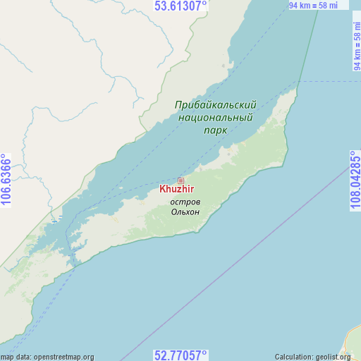
Khuzhir GPS coordinates[2]
53° 11' 38.004" North, 107° 20' 22.992" East
| Map corner | latitude | longitude |
|---|---|---|
| Upper-left | 53.61307°, | 106.6366° |
| Center: | 53.19389°, | 107.33972° |
| Lower-right: | 52.77057°, | 108.04285° |
| Map W x H: | 93.7×93.7 km | = 58.2×58.2mi |
| max Lat: | 73.50819° ⇑61.5% North |
| Khuzhir: | 53.19389° |
| min Lat: | ⇓38.5% South 41.28413° |
| min Long | Khuzhir | max Long |
| -179.12198° | 107.33972° | 179.35046° |
| W 90.4%⇐ | ⇒9.6% E |
Elevation
Elevation of Khuzhir is 471 m = 1545 ft, and this is 268.4 m = 881 ft above average elevation for this country.
| Max E: |
2518 m = 8261 ft | 9.3% |
| Khuzhir | 471 m 1545 ft | |
| Avg. | 202.6 m = 665 ft | |
Min E: |
-28 m = -92 ft | 90.7% |
See also: Russia elevation on elevation.city.
Geographical zone
Khuzhir is located in North temperate zone (between Tropic of Cancer and the Arctic Circle). Distance of this North polar circle is 1486.6 km =923.7 mi to North.| Distance of | km | miles | from Khuzhir |
|---|---|---|---|
| North Pole | 4092.5 | 2543 | to North |
| Arctic Circle | 1486.6 | 923.7 | to North |
| Tropic Cancer | 3308.7 | 2055.9 | to South |
| Equator | 5914.6 | 3675.2 | to South |


Nearby cities:
15 places around Khuzhir: (largest is in red/bold)
• Bayanday
122.6 km =76.2 mi,  263°
263°
• Biryul’ka
100.1 km =62.2 mi,  318°
318°
• Bugul’deyka
111.4 km =69.2 mi,  229°
229°
• Il’inka
119.6 km =74.3 mi,  182°
182°
• Istok
142.7 km =88.7 mi,  211°
211°
• Kabansk
135.5 km =84.2 mi,  200°
200°
• Kachug
128.6 km =79.9 mi,  311°
311°
• Manzurka
91.3 km =56.7 mi,  290°
290°
• Onokhoy
149 km =92.6 mi,  160°
160°
• Sotnikovo
145.9 km =90.7 mi, 176°
• Tataurovo
117.2 km =72.8 mi, 176°
• Turka
64.9 km =40.3 mi,  114°
114°
• Turuntayevo
112.2 km =69.7 mi,  169°
169°
• Ust’-Barguzin
114.9 km =71.4 mi,  77°
77°
• Yelantsy
76.2 km =47.3 mi,  235°
235°
Sources, notices
• [Note1] Compared only with cities in Russia existing in our database
• [Src1] Map data: © OpenStreetMap contributors (CC-BY-SA)
• [Src2] Other city data from geonames.org with taken over terms of usage.
• [Src3] Geographical zone / Annual Mean Temperature by Robert A. Rohde @ Wikipedia
