Aksha geodata
Aksha (Transbaikal Territory) is a populated place; located in Russia in Asia/Chita (GMT+9) time zone. With population of 3,950 people, there are 3142 cities with bigger population in this country. Compared to other cities in Russia, 77.3% of cities are located further ↑North; 91.7% of cities are located further ←West and 96.5% of cities have lower elevation than Aksha. Note1


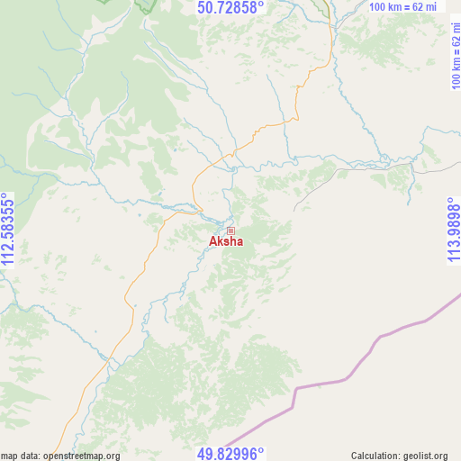
Aksha GPS coordinates[2]
50° 16' 53.004" North, 113° 17' 12.012" East
| Map corner | latitude | longitude |
|---|---|---|
| Upper-left | 50.72858°, | 112.58355° |
| Center: | 50.28139°, | 113.28667° |
| Lower-right: | 49.82996°, | 113.9898° |
| Map W x H: | 99.9×99.9 km | = 62.1×62.1mi |
| max Lat: | 73.50819° ⇑77.3% North |
| Aksha: | 50.28139° |
| min Lat: | ⇓22.7% South 41.28413° |
| min Long | Aksha | max Long |
| -179.12198° | 113.28667° | 179.35046° |
| W 91.7%⇐ | ⇒8.3% E |
Elevation
Elevation of Aksha is 732 m = 2402 ft, and this is 529.4 m = 1737 ft above average elevation for this country.
| Max E: |
2518 m = 8261 ft | 3.5% |
| Aksha | 732 m 2402 ft | |
| Avg. | 202.6 m = 665 ft | |
Min E: |
-28 m = -92 ft | 96.5% |
See also: Russia elevation on elevation.city.
Geographical zone
Aksha is located in North temperate zone (between Tropic of Cancer and the Arctic Circle). Distance of this North polar circle is 1810.4 km =1124.9 mi to North.| Distance of | km | miles | from Aksha |
|---|---|---|---|
| North Pole | 4416.3 | 2744.2 | to North |
| Arctic Circle | 1810.4 | 1124.9 | to North |
| Tropic Cancer | 2984.8 | 1854.7 | to South |
| Equator | 5590.8 | 3474 | to South |


Nearby cities:
15 places around Aksha: (largest is in red/bold)
• Aginskoye
126.3 km =78.5 mi,  43°
43°
• Bol’shaya Tura
159.3 km =99 mi,  21°
21°
• Budulan
118.6 km =73.7 mi,  74°
74°
• Darasun
160.6 km =99.8 mi, 17°
• Drovyanaya
145 km =90.1 mi,  353°
353°
• Dul’durga
49 km =30.4 mi,  26°
26°
• Guney
93.7 km =58.2 mi, 73°
• Karymskoye
166.1 km =103.2 mi, 26°
• Kurort-Darasun
106.4 km =66.1 mi, 16°
• Kyra
122 km =75.8 mi,  230°
230°
• Mogoytuy
159.8 km =99.3 mi,  45°
45°
• Nizhniy Tsasuchey
133.5 km =83 mi,  78°
78°
• Novoorlovsk
134.5 km =83.6 mi, 48°
• Orlovskiy
137.4 km =85.4 mi, 52°
• Ulety
132.1 km =82.1 mi,  334°
334°
Sources, notices
• [Note1] Compared only with cities in Russia existing in our database
• [Src1] Map data: © OpenStreetMap contributors (CC-BY-SA)
• [Src2] Other city data from geonames.org with taken over terms of usage.
• [Src3] Geographical zone / Annual Mean Temperature by Robert A. Rohde @ Wikipedia
