Budulan geodata
Budulan (Transbaikal Territory) is a populated place; located in Russia in Asia/Chita (GMT+9) time zone. With population of 769 people, there are 4779 cities with bigger population in this country. Compared to other cities in Russia, 76.4% of cities are located further ↑North; 92.2% of cities are located further ←West and 95.7% of cities have lower elevation than Budulan. Note1


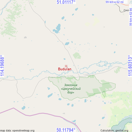
Budulan GPS coordinates[2]
50° 34' 0.012" North, 114° 54' 0" East
| Map corner | latitude | longitude |
|---|---|---|
| Upper-left | 51.01117°, | 114.19688° |
| Center: | 50.56667°, | 114.9° |
| Lower-right: | 50.11794°, | 115.60313° |
| Map W x H: | 99.3×99.3 km | = 61.7×61.7mi |
| max Lat: | 73.50819° ⇑76.4% North |
| Budulan: | 50.56667° |
| min Lat: | ⇓23.6% South 41.28413° |
| min Long | Budulan | max Long |
| -179.12198° | 114.9° | 179.35046° |
| W 92.2%⇐ | ⇒7.8% E |
Elevation
Elevation of Budulan is 680 m = 2231 ft, and this is 477.4 m = 1566 ft above average elevation for this country.
| Max E: |
2518 m = 8261 ft | 4.3% |
| Budulan | 680 m 2231 ft | |
| Avg. | 202.6 m = 665 ft | |
Min E: |
-28 m = -92 ft | 95.7% |
See also: Russia elevation on elevation.city.
Geographical zone
Budulan is located in North temperate zone (between Tropic of Cancer and the Arctic Circle). Distance of this North polar circle is 1778.7 km =1105.2 mi to North.| Distance of | km | miles | from Budulan |
|---|---|---|---|
| North Pole | 4384.6 | 2724.5 | to North |
| Arctic Circle | 1778.7 | 1105.2 | to North |
| Tropic Cancer | 3016.6 | 1874.4 | to South |
| Equator | 5622.5 | 3493.7 | to South |


Nearby cities:
15 places around Budulan: (largest is in red/bold)
• Aginskoye
64.7 km =40.2 mi,  336°
336°
• Aksha
118.6 km =73.7 mi,  254°
254°
• Bol’shaya Tura
129 km =80.2 mi,  334°
334°
• Borzya
116.2 km =72.2 mi,  100°
100°
• Dul’durga
93 km =57.8 mi,  277°
277°
• Guney
25 km =15.5 mi,  256°
256°
• Kalanguy
124.2 km =77.2 mi,  66°
66°
• Karymskoye
122.9 km =76.4 mi, 341°
• Kurort-Darasun
108.8 km =67.6 mi,  310°
310°
• Mogoytuy
79.7 km =49.5 mi,  0°
0°
• Nizhniy Tsasuchey
17.4 km =10.8 mi,  108°
108°
• Novoorlovsk
57.9 km =36 mi,  347°
347°
• Olovyannaya
63.4 km =39.4 mi,  47°
47°
• Orlovskiy
52.1 km =32.4 mi, 354°
• Pervomayskiy
132.7 km =82.5 mi,  22°
22°
Sources, notices
• [Note1] Compared only with cities in Russia existing in our database
• [Src1] Map data: © OpenStreetMap contributors (CC-BY-SA)
• [Src2] Other city data from geonames.org with taken over terms of usage.
• [Src3] Geographical zone / Annual Mean Temperature by Robert A. Rohde @ Wikipedia
