Zabaykal’sk geodata
Zabaykal’sk (Transbaikal Territory) is a populated place; located in Russia in Asia/Chita (GMT+9) time zone. With population of 10,563 people, there are 1438 cities with bigger population in this country. Compared to other cities in Russia, 78.4% of cities are located further ↑North; 92.6% of cities are located further ←West and 95.9% of cities have lower elevation than Zabaykal’sk. Note1


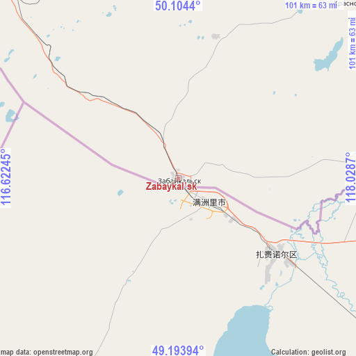
Zabaykal’sk GPS coordinates[2]
49° 39' 4.68" North, 117° 19' 32.052" East
| Map corner | latitude | longitude |
|---|---|---|
| Upper-left | 50.1044°, | 116.62245° |
| Center: | 49.6513°, | 117.32557° |
| Lower-right: | 49.19394°, | 118.0287° |
| Map W x H: | 101.2×101.2 km | = 62.9×62.9mi |
| max Lat: | 73.50819° ⇑78.4% North |
| Zabaykal’sk: | 49.6513° |
| min Lat: | ⇓21.6% South 41.28413° |
| min Long | Zabaykal’sk | max Long |
| -179.12198° | 117.32557° | 179.35046° |
| W 92.6%⇐ | ⇒7.4% E |
Elevation
Elevation of Zabaykal’sk is 687 m = 2254 ft, and this is 484.4 m = 1589 ft above average elevation for this country.
| Max E: |
2518 m = 8261 ft | 4.1% |
| Zabaykal’sk | 687 m 2254 ft | |
| Avg. | 202.6 m = 665 ft | |
Min E: |
-28 m = -92 ft | 95.9% |
See also: Russia elevation on elevation.city.
Geographical zone
Zabaykal’sk is located in North temperate zone (between Tropic of Cancer and the Arctic Circle). Distance of this North polar circle is 1880.5 km =1168.5 mi to North.| Distance of | km | miles | from Zabaykal’sk |
|---|---|---|---|
| North Pole | 4486.4 | 2787.7 | to North |
| Arctic Circle | 1880.5 | 1168.5 | to North |
| Tropic Cancer | 2914.8 | 1811.2 | to South |
| Equator | 5520.7 | 3430.4 | to South |


Nearby cities:
15 places around Zabaykal’sk: (largest is in red/bold)
• Abagaytuy
37.4 km =23.2 mi,  101°
101°
• Aleksandrovskiy Zavod
148.2 km =92.1 mi,  17°
17°
• Borzya
99.8 km =62 mi,  324°
324°
• Budulan
200.7 km =124.7 mi,  300°
300°
• Dauriya
45.5 km =28.3 mi,  313°
313°
• Guney
219.6 km =136.5 mi, 295°
• Kadaya
199.6 km =124 mi,  44°
44°
• Kalanguy
162.3 km =100.8 mi,  339°
339°
• Kalga
180.5 km =112.2 mi, 38°
• Klichka
100.5 km =62.4 mi,  28°
28°
• Krasnokamensk
71.2 km =44.2 mi,  45°
45°
• Nizhniy Tsasuchey
183.6 km =114.1 mi, 301°
• Olovyannaya
190.9 km =118.6 mi, 319°
• Priargunsk
149.9 km =93.1 mi,  57°
57°
• Vershino-Shakhtaminskiy
187.6 km =116.6 mi,  12°
12°
Sources, notices
• [Note1] Compared only with cities in Russia existing in our database
• [Src1] Map data: © OpenStreetMap contributors (CC-BY-SA)
• [Src2] Other city data from geonames.org with taken over terms of usage.
• [Src3] Geographical zone / Annual Mean Temperature by Robert A. Rohde @ Wikipedia
