Olovyannaya geodata
Olovyannaya (Transbaikal Territory) is a populated place; located in Russia in Asia/Chita (GMT+9) time zone. With population of 8,247 people, there are 1762 cities with bigger population in this country. Compared to other cities in Russia, 75.1% of cities are located further ↑North; 92.3% of cities are located further ←West and 94.8% of cities have lower elevation than Olovyannaya. Note1


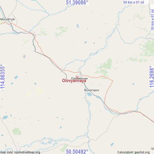
Olovyannaya GPS coordinates[2]
50° 57' 0" North, 115° 34' 0.012" East
| Map corner | latitude | longitude |
|---|---|---|
| Upper-left | 51.39086°, | 114.86355° |
| Center: | 50.95°, | 115.56667° |
| Lower-right: | 50.50492°, | 116.2698° |
| Map W x H: | 98.5×98.5 km | = 61.2×61.2mi |
| max Lat: | 73.50819° ⇑75.1% North |
| Olovyannaya: | 50.95° |
| min Lat: | ⇓24.9% South 41.28413° |
| min Long | Olovyannaya | max Long |
| -179.12198° | 115.56667° | 179.35046° |
| W 92.3%⇐ | ⇒7.7% E |
Elevation
Elevation of Olovyannaya is 622 m = 2041 ft, and this is 419.4 m = 1376 ft above average elevation for this country.
| Max E: |
2518 m = 8261 ft | 5.2% |
| Olovyannaya | 622 m 2041 ft | |
| Avg. | 202.6 m = 665 ft | |
Min E: |
-28 m = -92 ft | 94.8% |
See also: Russia elevation on elevation.city.
Geographical zone
Olovyannaya is located in North temperate zone (between Tropic of Cancer and the Arctic Circle). Distance of this North polar circle is 1736.1 km =1078.8 mi to North.| Distance of | km | miles | from Olovyannaya |
|---|---|---|---|
| North Pole | 4342 | 2698 | to North |
| Arctic Circle | 1736.1 | 1078.8 | to North |
| Tropic Cancer | 3059.2 | 1900.9 | to South |
| Equator | 5665.1 | 3520.1 | to South |


Nearby cities:
15 places around Olovyannaya: (largest is in red/bold)
• Aginskoye
74.4 km =46.2 mi,  282°
282°
• Arbagar
119.2 km =74.1 mi,  23°
23°
• Baley
102.2 km =63.5 mi,  46°
46°
• Borzya
91.9 km =57.1 mi,  133°
133°
• Budulan
63.4 km =39.4 mi,  227°
227°
• Guney
86 km =53.4 mi,  235°
235°
• Kalanguy
66.9 km =41.6 mi,  83°
83°
• Karymskoye
112.5 km =69.9 mi,  311°
311°
• Kholbon
114.1 km =70.9 mi, 24°
• Mogoytuy
58.6 km =36.4 mi, 309°
• Nizhniy Tsasuchey
57 km =35.4 mi,  212°
212°
• Novoorlovsk
60.4 km =37.5 mi, 283°
• Orlovskiy
52.2 km =32.4 mi, 280°
• Pervomayskiy
80.2 km =49.8 mi,  2°
2°
• Shilka
105.2 km =65.4 mi, 17°
Sources, notices
• [Note1] Compared only with cities in Russia existing in our database
• [Src1] Map data: © OpenStreetMap contributors (CC-BY-SA)
• [Src2] Other city data from geonames.org with taken over terms of usage.
• [Src3] Geographical zone / Annual Mean Temperature by Robert A. Rohde @ Wikipedia
