Sokol geodata
Sokol (Magadan Oblast) is a populated place; located in Russia in Asia/Magadan (GMT+11) time zone. With population of 4,374 people, there are 2922 cities with bigger population in this country. Compared to other cities in Russia, 89.6% of cities are located further ↓South; 99.2% of cities are located further ←West and 71.2% of cities have lower elevation than Sokol. Note1


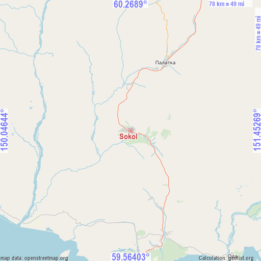
Sokol GPS coordinates[2]
59° 55' 6.024" North, 150° 44' 58.416" East
| Map corner | latitude | longitude |
|---|---|---|
| Upper-left | 60.2689°, | 150.04644° |
| Center: | 59.91834°, | 150.74956° |
| Lower-right: | 59.56403°, | 151.45269° |
| Map W x H: | 78.4×78.4 km | = 48.7×48.7mi |
| max Lat: | 73.50819° ⇑10.4% North |
| Sokol: | 59.91834° |
| min Lat: | ⇓89.6% South 41.28413° |
| min Long | Sokol | max Long |
| -179.12198° | 150.74956° | 179.35046° |
| W 99.2%⇐ | ⇒0.8% E |
Elevation
Elevation of Sokol is 201 m = 659 ft, and this is 1.6 m = 5 ft below average elevation for this country.
| Max E: |
2518 m = 8261 ft | 28.8% |
| Avg. | 202.6 m = 665 ft | |
| Sokol | 201 m = 659 ft | |
Min E: |
-28 m = -92 ft | 71.2% |
See also: Russia elevation on elevation.city.
Geographical zone
Sokol is located in North temperate zone (between Tropic of Cancer and the Arctic Circle). Distance of this North polar circle is 738.9 km =459.1 mi to North.| Distance of | km | miles | from Sokol |
|---|---|---|---|
| North Pole | 3344.8 | 2078.4 | to North |
| Arctic Circle | 738.9 | 459.1 | to North |
| Tropic Cancer | 4056.4 | 2520.5 | to South |
| Equator | 6662.3 | 4139.8 | to South |


Nearby cities:
15 places around Sokol: (largest is in red/bold)
• Arman’
44.2 km =27.5 mi,  231°
231°
• Atka
116.9 km =72.6 mi,  29°
29°
• Burkhala
315.8 km =196.2 mi,  343°
343°
• Debin
269.5 km =167.5 mi,  0°
0°
• Karamken
37.6 km =23.4 mi, 30°
• Magadan
39.5 km =24.5 mi,  175°
175°
• Ola
48.7 km =30.3 mi,  140°
140°
• Orotukan
265.5 km =165 mi,  10°
10°
• Palatka
22.8 km =14.2 mi, 26°
• Sinegor'ye
241.5 km =150.1 mi,  357°
357°
• Spornoye
270.1 km =167.8 mi, 4°
• Talaya
195.4 km =121.4 mi, 34°
• Uptar
7.2 km =4.5 mi,  107°
107°
• Ust’-Omchug
148.3 km =92.1 mi, 335°
• Yagodnoye
295.9 km =183.9 mi,  348°
348°
Sources, notices
• [Note1] Compared only with cities in Russia existing in our database
• [Src1] Map data: © OpenStreetMap contributors (CC-BY-SA)
• [Src2] Other city data from geonames.org with taken over terms of usage.
• [Src3] Geographical zone / Annual Mean Temperature by Robert A. Rohde @ Wikipedia
