Velikent geodata
Velikent (Dagestan) is a populated place; located in Russia in Europe/Moscow (GMT+3) time zone. With population of 4,020 people, there are 3097 cities with bigger population in this country. Compared to other cities in Russia, 99.3% of cities are located further ↑North; 59.1% of cities are located further ←West and 87% of cities have higher elevation than Velikent. Note1


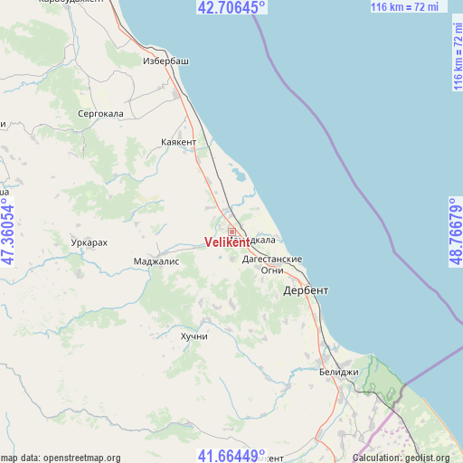
Velikent GPS coordinates[2]
42° 11' 15.432" North, 48° 3' 49.176" East
| Map corner | latitude | longitude |
|---|---|---|
| Upper-left | 42.70645°, | 47.36054° |
| Center: | 42.18762°, | 48.06366° |
| Lower-right: | 41.66449°, | 48.76679° |
| Map W x H: | 115.9×115.9 km | = 72×72mi |
| max Lat: | 73.50819° ⇑99.3% North |
| Velikent: | 42.18762° |
| min Lat: | ⇓0.7% South 41.28413° |
| min Long | Velikent | max Long |
| -179.12198° | 48.06366° | 179.35046° |
| W 59.1%⇐ | ⇒40.9% E |
Elevation
Elevation of Velikent is 40 m = 131 ft, and this is 162.6 m = 533 ft below average elevation for this country.
| Max E: |
2518 m = 8261 ft | 87% |
| Avg. | 202.6 m = 665 ft | |
| Velikent | 40 m = 131 ft | |
Min E: |
-28 m = -92 ft | 13% |
See also: Russia elevation on elevation.city.
Geographical zone
Velikent is located in North temperate zone (between Tropic of Cancer and the Arctic Circle). Distance of this Northern Tropic circle is 2084.9 km =1295.5 mi to South.| Distance of | km | miles | from Velikent |
|---|---|---|---|
| North Pole | 5316.2 | 3303.3 | to North |
| Arctic Circle | 2710.4 | 1684.2 | to North |
| Tropic Cancer | 2084.9 | 1295.5 | to South |
| Equator | 4690.8 | 2914.7 | to South |


Nearby cities:
15 places around Velikent: (largest is in red/bold)
• Chinar
11 km =6.8 mi,  143°
143°
• Dagestanskiye Ogni
13.3 km =8.3 mi,  127°
127°
• Derbent
22.9 km =14.2 mi, 125°
• Druzhba
7.9 km =4.9 mi,  319°
319°
• Gedzhukh
6.6 km =4.1 mi,  179°
179°
• Gerga
19.5 km =12.1 mi,  334°
334°
• Kayakent
25.8 km =16 mi, 329°
• Khazar
30.7 km =19.1 mi, 133°
• Khuchni
28.1 km =17.5 mi,  199°
199°
• Madzhalis
20.4 km =12.7 mi,  248°
248°
• Mamedkala
4.9 km =3 mi,  117°
117°
• Novokayakent
23.8 km =14.8 mi,  344°
344°
• Sabnova
20.9 km =13 mi, 131°
• Urkarakh
35.8 km =22.2 mi,  265°
265°
• Utamysh
35.5 km =22.1 mi,  313°
313°
Sources, notices
• [Note1] Compared only with cities in Russia existing in our database
• [Src1] Map data: © OpenStreetMap contributors (CC-BY-SA)
• [Src2] Other city data from geonames.org with taken over terms of usage.
• [Src3] Geographical zone / Annual Mean Temperature by Robert A. Rohde @ Wikipedia
