Dagestanskiye Ogni geodata
Dagestanskiye Ogni (Dagestan) is a populated place; located in Russia in Europe/Moscow (GMT+3) time zone. With population of 27,835 people, there are 705 cities with bigger population in this country. Compared to other cities in Russia, 99.5% of cities are located further ↑North; 59.3% of cities are located further ←West and 88.1% of cities have higher elevation than Dagestanskiye Ogni. Note1


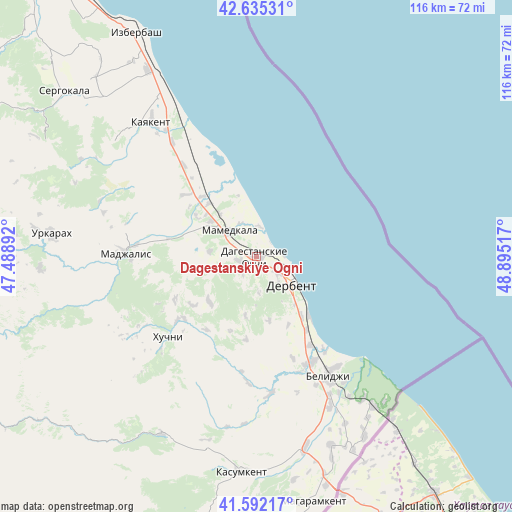
Dagestanskiye Ogni GPS coordinates[2]
42° 6' 57.204" North, 48° 11' 31.344" East
| Map corner | latitude | longitude |
|---|---|---|
| Upper-left | 42.63531°, | 47.48892° |
| Center: | 42.11589°, | 48.19204° |
| Lower-right: | 41.59217°, | 48.89517° |
| Map W x H: | 116×116 km | = 72.1×72.1mi |
| max Lat: | 73.50819° ⇑99.5% North |
| Dagestanskiye Ogni: | 42.11589° |
| min Lat: | ⇓0.5% South 41.28413° |
| min Long | Dagestanskiye O | max Long |
| -179.12198° | 48.19204° | 179.35046° |
| W 59.3%⇐ | ⇒40.7% E |
Elevation
Elevation of Dagestanskiye Ogni is 36 m = 118 ft, and this is 166.6 m = 547 ft below average elevation for this country.
| Max E: |
2518 m = 8261 ft | 88.1% |
| Avg. | 202.6 m = 665 ft | |
| Dagestanskiye Ogni | 36 m = 118 ft | |
Min E: |
-28 m = -92 ft | 11.9% |
See also: Russia elevation on elevation.city.
Geographical zone
Dagestanskiye Ogni is located in North temperate zone (between Tropic of Cancer and the Arctic Circle). Distance of this Northern Tropic circle is 2076.9 km =1290.5 mi to South.| Distance of | km | miles | from Dagestanskiye Ogni |
|---|---|---|---|
| North Pole | 5324.2 | 3308.3 | to North |
| Arctic Circle | 2718.3 | 1689.1 | to North |
| Tropic Cancer | 2076.9 | 1290.5 | to South |
| Equator | 4682.8 | 2909.8 | to South |


Nearby cities:
15 places around Dagestanskiye Ogni: (largest is in red/bold)
• Belidzhi
30.9 km =19.2 mi,  143°
143°
• Chinar
4.1 km =2.5 mi,  257°
257°
• Derbent
9.7 km =6 mi,  123°
123°
• Druzhba
21.1 km =13.1 mi,  311°
311°
• Gedzhukh
10.6 km =6.6 mi,  277°
277°
• Gerga
31.8 km =19.8 mi,  323°
323°
• Kayakent
38.4 km =23.9 mi, 321°
• Khazar
17.6 km =10.9 mi, 138°
• Khuchni
27.3 km =17 mi,  227°
227°
• Madzhalis
29.6 km =18.4 mi,  271°
271°
• Mamedkala
8.5 km =5.3 mi, 312°
• Novokayakent
35.2 km =21.9 mi,  331°
331°
• Sabnova
7.7 km =4.8 mi, 139°
• Syrtych
31.5 km =19.6 mi,  174°
174°
• Velikent
13.3 km =8.3 mi, 307°
Sources, notices
• [Note1] Compared only with cities in Russia existing in our database
• [Src1] Map data: © OpenStreetMap contributors (CC-BY-SA)
• [Src2] Other city data from geonames.org with taken over terms of usage.
• [Src3] Geographical zone / Annual Mean Temperature by Robert A. Rohde @ Wikipedia
