Kurlovo geodata
Kurlovo (Vladimir) is a populated place; located in Russia in Europe/Moscow (GMT+3) time zone. With population of 7,263 people, there are 1943 cities with bigger population in this country. Compared to other cities in Russia, 57.5% of cities are located further ↓South; 65.1% of cities are located further →East and 56.2% of cities have higher elevation than Kurlovo. Note1


Kurlovo GPS coordinates[2]
55° 25' 57.072" North, 40° 29' 7.404" East
| Map corner | latitude | longitude |
|---|---|---|
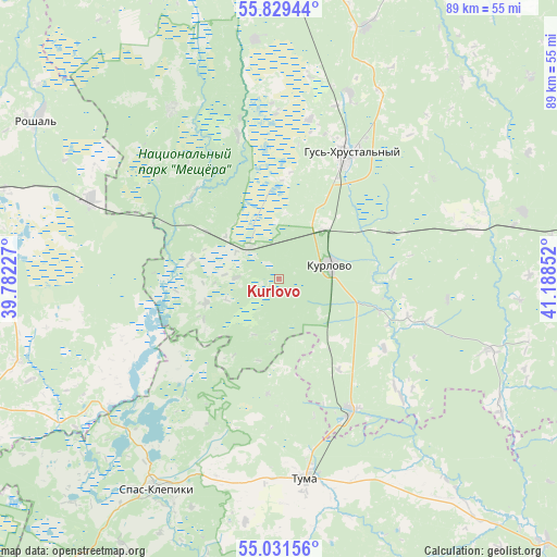
| Upper-left | 55.82944°, | 39.78227° |
| Center: | 55.43252°, | 40.48539° |
| Lower-right: | 55.03156°, | 41.18852° |
| Map W x H: | 88.7×88.7 km | = 55.1×55.1mi |
| max Lat: | 73.50819° ⇑42.5% North |
| Kurlovo: | 55.43252° |
| min Lat: | ⇓57.5% South 41.28413° |
| min Long | Kurlovo | max Long |
| -179.12198° | 40.48539° | 179.35046° |
| W 34.9%⇐ | ⇒65.1% E |
Elevation
Elevation of Kurlovo is 132 m = 433 ft, and this is 70.6 m = 232 ft below average elevation for this country.
| Max E: |
2518 m = 8261 ft | 56.2% |
| Avg. | 202.6 m = 665 ft | |
| Kurlovo | 132 m = 433 ft | |
Min E: |
-28 m = -92 ft | 43.8% |
See also: Russia elevation on elevation.city.
Geographical zone
Kurlovo is located in North temperate zone (between Tropic of Cancer and the Arctic Circle). Distance of this North polar circle is 1237.7 km =769.1 mi to North.| Distance of | km | miles | from Kurlovo |
|---|---|---|---|
| North Pole | 3843.5 | 2388.2 | to North |
| Arctic Circle | 1237.7 | 769.1 | to North |
| Tropic Cancer | 3557.6 | 2210.6 | to South |
| Equator | 6163.5 | 3829.8 | to South |


Nearby cities:
15 places around Kurlovo: (largest is in red/bold)
• Anopino
31.7 km =19.7 mi,  21°
21°
• Cherusti
32.6 km =20.3 mi,  293°
293°
• Dmitrovskiy Pogost
43.3 km =26.9 mi,  252°
252°
• Erleks
19.9 km =12.4 mi,  341°
341°
• Gusevskiy
26 km =16.2 mi,  10°
10°
• Gus’-Khrustal’nyy
22.5 km =14 mi,  27°
27°
• Ivanishchi
38.2 km =23.7 mi,  354°
354°
• Mezinovskiy
11.3 km =7 mi,  315°
315°
• Savinskaya
31.9 km =19.8 mi,  257°
257°
• Spas-Klepiki
38.5 km =23.9 mi,  210°
210°
• Tugolesskiy Bor
43.7 km =27.2 mi, 287°
• Tuma
31.9 km =19.8 mi,  172°
172°
• Urshel’skiy
32.1 km =19.9 mi,  328°
328°
• Velikodvorskiy
23.3 km =14.5 mi,  150°
150°
• Zolotkovo
40.5 km =25.2 mi,  74°
74°
Sources, notices
• [Note1] Compared only with cities in Russia existing in our database
• [Src1] Map data: © OpenStreetMap contributors (CC-BY-SA)
• [Src2] Other city data from geonames.org with taken over terms of usage.
• [Src3] Geographical zone / Annual Mean Temperature by Robert A. Rohde @ Wikipedia
