Nizhnyaya Maktama geodata
Nizhnyaya Maktama (Tatarstan Republic) is a populated place; located in Russia in Europe/Moscow (GMT+3) time zone. With population of 10,600 people, there are 1433 cities with bigger population in this country. Compared to other cities in Russia, 51.7% of cities are located further ↓South; 64.4% of cities are located further ←West and 66.6% of cities have higher elevation than Nizhnyaya Maktama. Note1


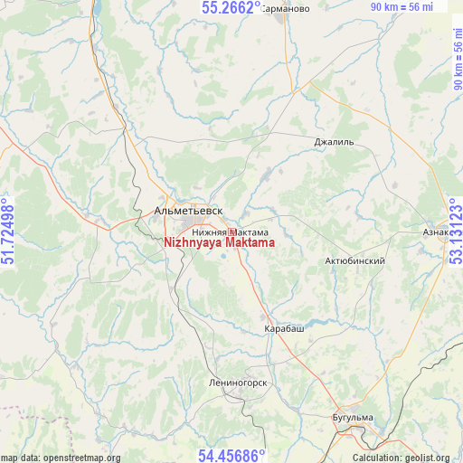
Nizhnyaya Maktama GPS coordinates[2]
54° 51' 48.816" North, 52° 25' 41.16" East
| Map corner | latitude | longitude |
|---|---|---|
| Upper-left | 55.2662°, | 51.72498° |
| Center: | 54.86356°, | 52.4281° |
| Lower-right: | 54.45686°, | 53.13123° |
| Map W x H: | 90×90 km | = 55.9×55.9mi |
| max Lat: | 73.50819° ⇑48.3% North |
| Nizhnyaya Maktama: | 54.86356° |
| min Lat: | ⇓51.7% South 41.28413° |
| min Long | Nizhnyaya Makta | max Long |
| -179.12198° | 52.4281° | 179.35046° |
| W 64.4%⇐ | ⇒35.6% E |
Elevation
Elevation of Nizhnyaya Maktama is 110 m = 361 ft, and this is 92.6 m = 304 ft below average elevation for this country.
| Max E: |
2518 m = 8261 ft | 66.6% |
| Avg. | 202.6 m = 665 ft | |
| Nizhnyaya Maktama | 110 m = 361 ft | |
Min E: |
-28 m = -92 ft | 33.4% |
See also: Russia elevation on elevation.city.
Geographical zone
Nizhnyaya Maktama is located in North temperate zone (between Tropic of Cancer and the Arctic Circle). Distance of this North polar circle is 1300.9 km =808.3 mi to North.| Distance of | km | miles | from Nizhnyaya Maktama |
|---|---|---|---|
| North Pole | 3906.8 | 2427.6 | to North |
| Arctic Circle | 1300.9 | 808.3 | to North |
| Tropic Cancer | 3494.3 | 2171.3 | to South |
| Equator | 6100.3 | 3790.5 | to South |


Nearby cities:
15 places around Nizhnyaya Maktama: (largest is in red/bold)
• Aktyubinskiy
24.8 km =15.4 mi,  102°
102°
• Al’met’yevsk
8.5 km =5.3 mi,  302°
302°
• Bavly
74.9 km =46.5 mi,  134°
134°
• Bugul’ma
43.3 km =26.9 mi,  146°
146°
• Cheremshan
63.4 km =39.4 mi,  249°
249°
• Dzhalil’
26.5 km =16.5 mi,  47°
47°
• Karabash
21.4 km =13.3 mi, 152°
• Klyavlino
71.4 km =44.4 mi,  201°
201°
• Leninogorsk
29.1 km =18.1 mi,  175°
175°
• Muslyumovo
69.1 km =42.9 mi,  44°
44°
• Russkiy Aktash
27.6 km =17.1 mi,  314°
314°
• Sarmanovo
44.7 km =27.8 mi,  13°
13°
• Shugurovo
43.8 km =27.2 mi,  205°
205°
• Urussu
72.7 km =45.2 mi,  113°
113°
• Zainsk
55.6 km =34.5 mi,  335°
335°
Sources, notices
• [Note1] Compared only with cities in Russia existing in our database
• [Src1] Map data: © OpenStreetMap contributors (CC-BY-SA)
• [Src2] Other city data from geonames.org with taken over terms of usage.
• [Src3] Geographical zone / Annual Mean Temperature by Robert A. Rohde @ Wikipedia
