Khandagayty geodata
Khandagayty (Republic of Tyva) is a populated place; located in Russia in Asia/Krasnoyarsk (GMT+7) time zone. With population of 3,146 people, there are 3650 cities with bigger population in this country. Compared to other cities in Russia, 75.8% of cities are located further ↑North; 86.4% of cities are located further ←West and 98.9% of cities have lower elevation than Khandagayty. Note1


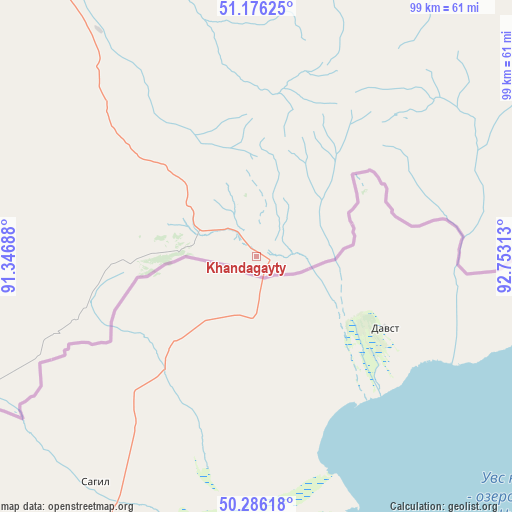
Khandagayty GPS coordinates[2]
50° 43' 59.988" North, 92° 3' 0" East
| Map corner | latitude | longitude |
|---|---|---|
| Upper-left | 51.17625°, | 91.34688° |
| Center: | 50.73333°, | 92.05° |
| Lower-right: | 50.28618°, | 92.75313° |
| Map W x H: | 99×99 km | = 61.5×61.5mi |
| max Lat: | 73.50819° ⇑75.8% North |
| Khandagayty: | 50.73333° |
| min Lat: | ⇓24.2% South 41.28413° |
| min Long | Khandagayty | max Long |
| -179.12198° | 92.05° | 179.35046° |
| W 86.4%⇐ | ⇒13.6% E |
Elevation
Elevation of Khandagayty is 1182 m = 3878 ft, and this is 979.4 m = 3213 ft above average elevation for this country.
| Max E: |
2518 m = 8261 ft | 1.1% |
| Khandagayty | 1182 m 3878 ft | |
| Avg. | 202.6 m = 665 ft | |
Min E: |
-28 m = -92 ft | 98.9% |
See also: Russia elevation on elevation.city.
Geographical zone
Khandagayty is located in North temperate zone (between Tropic of Cancer and the Arctic Circle). Distance of this North polar circle is 1760.2 km =1093.7 mi to North.| Distance of | km | miles | from Khandagayty |
|---|---|---|---|
| North Pole | 4366 | 2712.9 | to North |
| Arctic Circle | 1760.2 | 1093.7 | to North |
| Tropic Cancer | 3035.1 | 1885.9 | to South |
| Equator | 5641 | 3505.2 | to South |


Nearby cities:
15 places around Khandagayty: (largest is in red/bold)
• Ak-Dovurak
113.2 km =70.3 mi,  296°
296°
• Bay-Khaak
175.6 km =109.1 mi,  74°
74°
• Chadan
69.3 km =43.1 mi,  331°
331°
• Kaa-Khem
214.7 km =133.4 mi,  60°
60°
• Khovu-Aksy
124.7 km =77.5 mi, 69°
• Kyzyl
199.5 km =124 mi, 56°
• Kyzyl-Khaya
171.7 km =106.7 mi,  243°
243°
• Kyzyl-Mazhalyk
112.7 km =70 mi,  294°
294°
• Mugur-Aksy
120.5 km =74.9 mi,  251°
251°
• Samagaltay
208.7 km =129.7 mi,  94°
94°
• Shagonar
108.2 km =67.2 mi,  34°
34°
• Sukpak
207.7 km =129.1 mi, 60°
• Sut-Khol’
91.7 km =57 mi,  324°
324°
• Teeli
133.1 km =82.7 mi,  283°
283°
• Turan
203.5 km =126.4 mi,  39°
39°
Sources, notices
• [Note1] Compared only with cities in Russia existing in our database
• [Src1] Map data: © OpenStreetMap contributors (CC-BY-SA)
• [Src2] Other city data from geonames.org with taken over terms of usage.
• [Src3] Geographical zone / Annual Mean Temperature by Robert A. Rohde @ Wikipedia
