Kyzyl-Mazhalyk geodata
Kyzyl-Mazhalyk (Republic of Tyva) is a populated place; located in Russia in Asia/Krasnoyarsk (GMT+7) time zone. With population of 5,004 people, there are 2654 cities with bigger population in this country. Compared to other cities in Russia, 74.3% of cities are located further ↑North; 85.9% of cities are located further ←West and 97.9% of cities have lower elevation than Kyzyl-Mazhalyk. Note1


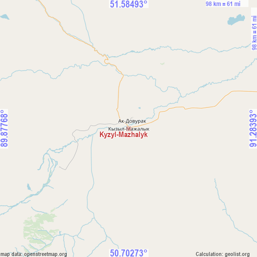
Kyzyl-Mazhalyk GPS coordinates[2]
51° 8' 45.384" North, 90° 34' 50.88" East
| Map corner | latitude | longitude |
|---|---|---|
| Upper-left | 51.58493°, | 89.87768° |
| Center: | 51.14594°, | 90.5808° |
| Lower-right: | 50.70273°, | 91.28393° |
| Map W x H: | 98.1×98.1 km | = 61×61mi |
| max Lat: | 73.50819° ⇑74.3% North |
| Kyzyl-Mazhalyk: | 51.14594° |
| min Lat: | ⇓25.7% South 41.28413° |
| min Long | Kyzyl-Mazhalyk | max Long |
| -179.12198° | 90.5808° | 179.35046° |
| W 85.9%⇐ | ⇒14.1% E |
Elevation
Elevation of Kyzyl-Mazhalyk is 858 m = 2815 ft, and this is 655.4 m = 2150 ft above average elevation for this country.
| Max E: |
2518 m = 8261 ft | 2.1% |
| Kyzyl-Mazhalyk | 858 m 2815 ft | |
| Avg. | 202.6 m = 665 ft | |
Min E: |
-28 m = -92 ft | 97.9% |
See also: Russia elevation on elevation.city.
Geographical zone
Kyzyl-Mazhalyk is located in North temperate zone (between Tropic of Cancer and the Arctic Circle). Distance of this North polar circle is 1714.3 km =1065.2 mi to North.| Distance of | km | miles | from Kyzyl-Mazhalyk |
|---|---|---|---|
| North Pole | 4320.2 | 2684.4 | to North |
| Arctic Circle | 1714.3 | 1065.2 | to North |
| Tropic Cancer | 3081 | 1914.4 | to South |
| Equator | 5686.9 | 3533.7 | to South |


Nearby cities:
15 places around Kyzyl-Mazhalyk: (largest is in red/bold)
• Abaza
171.1 km =106.3 mi,  348°
348°
• Ak-Dovurak
4.4 km =2.7 mi,  17°
17°
• Chadan
71.5 km =44.4 mi,  77°
77°
• Khandagayty
112.7 km =70 mi,  114°
114°
• Kosh-Agach
185.8 km =115.5 mi,  226°
226°
• Kyzyl-Khaya
131.6 km =81.8 mi,  202°
202°
• Mugur-Aksy
85.7 km =53.3 mi,  186°
186°
• Shagonar
168.9 km =104.9 mi, 75°
• Sut-Khol’
57.4 km =35.7 mi,  59°
59°
• Tashanta
186.9 km =116.1 mi,  211°
211°
• Tashtyp
189.3 km =117.6 mi, 345°
• Tebeler
186.3 km =115.8 mi,  222°
222°
• Teeli
30.1 km =18.7 mi,  240°
240°
• Ust’-Ulagan
192.4 km =119.6 mi,  252°
252°
• Жана-Аул
186 km =115.6 mi, 219°
Sources, notices
• [Note1] Compared only with cities in Russia existing in our database
• [Src1] Map data: © OpenStreetMap contributors (CC-BY-SA)
• [Src2] Other city data from geonames.org with taken over terms of usage.
• [Src3] Geographical zone / Annual Mean Temperature by Robert A. Rohde @ Wikipedia
