Ak-Dovurak geodata
Ak-Dovurak (Republic of Tyva) is a populated place; located in Russia in Asia/Krasnoyarsk (GMT+7) time zone. With population of 12,593 people, there are 1229 cities with bigger population in this country. Compared to other cities in Russia, 74.1% of cities are located further ↑North; 85.9% of cities are located further ←West and 97.7% of cities have lower elevation than Ak-Dovurak. Note1


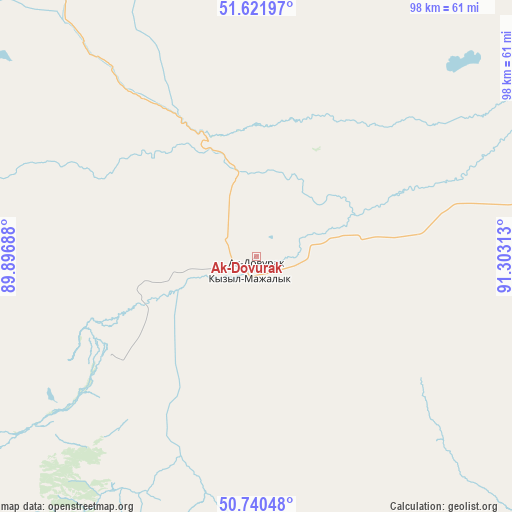
Ak-Dovurak GPS coordinates[2]
51° 10' 59.988" North, 90° 36' 0" East
| Map corner | latitude | longitude |
|---|---|---|
| Upper-left | 51.62197°, | 89.89688° |
| Center: | 51.18333°, | 90.6° |
| Lower-right: | 50.74048°, | 91.30313° |
| Map W x H: | 98×98 km | = 60.9×60.9mi |
| max Lat: | 73.50819° ⇑74.1% North |
| Ak-Dovurak: | 51.18333° |
| min Lat: | ⇓25.9% South 41.28413° |
| min Long | Ak-Dovurak | max Long |
| -179.12198° | 90.6° | 179.35046° |
| W 85.9%⇐ | ⇒14.1% E |
Elevation
Elevation of Ak-Dovurak is 841 m = 2759 ft, and this is 638.4 m = 2094 ft above average elevation for this country.
| Max E: |
2518 m = 8261 ft | 2.3% |
| Ak-Dovurak | 841 m 2759 ft | |
| Avg. | 202.6 m = 665 ft | |
Min E: |
-28 m = -92 ft | 97.7% |
See also: Russia elevation on elevation.city.
Geographical zone
Ak-Dovurak is located in North temperate zone (between Tropic of Cancer and the Arctic Circle). Distance of this North polar circle is 1710.1 km =1062.6 mi to North.| Distance of | km | miles | from Ak-Dovurak |
|---|---|---|---|
| North Pole | 4316 | 2681.8 | to North |
| Arctic Circle | 1710.1 | 1062.6 | to North |
| Tropic Cancer | 3085.1 | 1917 | to South |
| Equator | 5691.1 | 3536.3 | to South |


Nearby cities:
15 places around Ak-Dovurak: (largest is in red/bold)
• Abaza
167.3 km =104 mi,  348°
348°
• Chadan
69.4 km =43.1 mi,  80°
80°
• Cherëmushki
194.2 km =120.7 mi,  16°
16°
• Khandagayty
113.2 km =70.3 mi,  116°
116°
• Kosh-Agach
189.7 km =117.9 mi,  225°
225°
• Kyzyl-Khaya
135.9 km =84.4 mi,  201°
201°
• Kyzyl-Mazhalyk
4.4 km =2.7 mi, 197°
• Mugur-Aksy
90 km =55.9 mi,  187°
187°
• Shagonar
166.5 km =103.5 mi, 76°
• Sut-Khol’
54.2 km =33.7 mi,  62°
62°
• Tashanta
191.1 km =118.7 mi,  211°
211°
• Tashtyp
185.6 km =115.3 mi,  344°
344°
• Tebeler
190.3 km =118.2 mi,  222°
222°
• Teeli
33.4 km =20.8 mi,  235°
235°
• Жана-Аул
190.1 km =118.1 mi, 218°
In other languages:
- In France: Ak-Dovourak
- In German: Ak-Dowurak
- In Russian: Ак-Довурак
- In Chinese: 阿克多武拉克
Sources, notices
• [Note1] Compared only with cities in Russia existing in our database
• [Src1] Map data: © OpenStreetMap contributors (CC-BY-SA)
• [Src2] Other city data from geonames.org with taken over terms of usage.
• [Src3] Geographical zone / Annual Mean Temperature by Robert A. Rohde @ Wikipedia
