Mugur-Aksy geodata
Mugur-Aksy (Republic of Tyva) is a populated place; located in Russia in Asia/Krasnoyarsk (GMT+7) time zone. With population of 4,012 people, there are 3104 cities with bigger population in this country. Compared to other cities in Russia, 77% of cities are located further ↑North; 85.8% of cities are located further ←West and 99.8% of cities have lower elevation than Mugur-Aksy. Note1


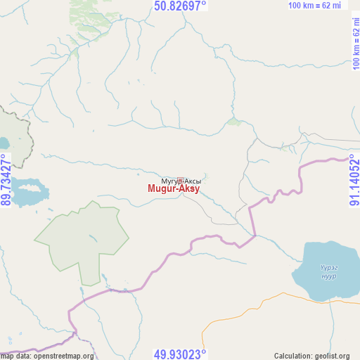
Mugur-Aksy GPS coordinates[2]
50° 22' 50.592" North, 90° 26' 14.604" East
| Map corner | latitude | longitude |
|---|---|---|
| Upper-left | 50.82697°, | 89.73427° |
| Center: | 50.38072°, | 90.43739° |
| Lower-right: | 49.93023°, | 91.14052° |
| Map W x H: | 99.7×99.7 km | = 62×62mi |
| max Lat: | 73.50819° ⇑77% North |
| Mugur-Aksy: | 50.38072° |
| min Lat: | ⇓23% South 41.28413° |
| min Long | Mugur-Aksy | max Long |
| -179.12198° | 90.43739° | 179.35046° |
| W 85.8%⇐ | ⇒14.2% E |
Elevation
Elevation of Mugur-Aksy is 1823 m = 5981 ft, and this is 1620.4 m = 5316 ft above average elevation for this country.
| Max E: |
2518 m = 8261 ft | 0.2% |
| Mugur-Aksy | 1823 m 5981 ft | |
| Avg. | 202.6 m = 665 ft | |
Min E: |
-28 m = -92 ft | 99.8% |
See also: Russia elevation on elevation.city.
Geographical zone
Mugur-Aksy is located in North temperate zone (between Tropic of Cancer and the Arctic Circle). Distance of this North polar circle is 1799.4 km =1118.1 mi to North.| Distance of | km | miles | from Mugur-Aksy |
|---|---|---|---|
| North Pole | 4405.3 | 2737.3 | to North |
| Arctic Circle | 1799.4 | 1118.1 | to North |
| Tropic Cancer | 2995.9 | 1861.6 | to South |
| Equator | 5601.8 | 3480.8 | to South |


Nearby cities:
15 places around Mugur-Aksy: (largest is in red/bold)
• Ak-Dovurak
90 km =55.9 mi,  7°
7°
• Aktash
192.1 km =119.4 mi,  267°
267°
• Balykcha
215.8 km =134.1 mi,  297°
297°
• Chadan
128.6 km =79.9 mi,  38°
38°
• Chibit
207.3 km =128.8 mi, 268°
• Khandagayty
120.5 km =74.9 mi,  71°
71°
• Kosh-Agach
132.6 km =82.4 mi,  251°
251°
• Kyzyl-Khaya
54.2 km =33.7 mi,  227°
227°
• Kyzyl-Mazhalyk
85.7 km =53.3 mi, 6°
• Sut-Khol’
128.9 km =80.1 mi,  27°
27°
• Tashanta
115.5 km =71.8 mi, 230°
• Tebeler
128.1 km =79.6 mi, 246°
• Teeli
72.3 km =44.9 mi,  346°
346°
• Ust’-Ulagan
177.4 km =110.2 mi,  279°
279°
• Жана-Аул
123.4 km =76.7 mi,  241°
241°
Sources, notices
• [Note1] Compared only with cities in Russia existing in our database
• [Src1] Map data: © OpenStreetMap contributors (CC-BY-SA)
• [Src2] Other city data from geonames.org with taken over terms of usage.
• [Src3] Geographical zone / Annual Mean Temperature by Robert A. Rohde @ Wikipedia
