Tystberga geodata
Tystberga (Södermanland) is a populated place; located in Sweden in Europe/Stockholm (GMT+2) time zone. With population of 869 people, there are 910 cities with bigger population in this country. Compared to other cities in Sweden, 51.8% of cities are located further ↓South; 76.9% of cities are located further ←West and 75.3% of cities have higher elevation than Tystberga. Note1


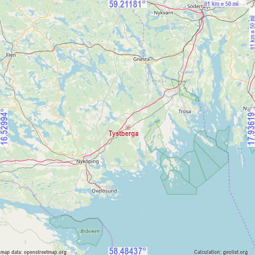
Tystberga GPS coordinates[2]
58° 51' 0" North, 17° 13' 59.016" East
| Map corner | latitude | longitude |
|---|---|---|
| Upper-left | 59.21181°, | 16.52994° |
| Center: | 58.85°, | 17.23306° |
| Lower-right: | 58.48437°, | 17.93619° |
| Map W x H: | 80.9×80.9 km | = 50.3×50.3mi |
| max Lat: | 67.85572° ⇑48.2% North |
| Tystberga: | 58.85° |
| min Lat: | ⇓51.8% South 55.34337° |
| min Long | Tystberga | max Long |
| 11.1712° | 17.23306° | 24.13676° |
| W 76.9%⇐ | ⇒23.1% E |
Elevation
Elevation of Tystberga is 20 m = 66 ft, and this is 62.6 m = 205 ft below average elevation for this country.
| Max E: |
663 m = 2175 ft | 75.3% |
| Avg. | 82.6 m = 271 ft | |
| Tystberga | 20 m = 66 ft | |
Min E: |
-1 m = -3 ft | 24.7% |
See also: Sweden elevation on elevation.city.
Geographical zone
Tystberga is located in North temperate zone (between Tropic of Cancer and the Arctic Circle). Distance of this North polar circle is 857.7 km =532.9 mi to North.| Distance of | km | miles | from Tystberga |
|---|---|---|---|
| North Pole | 3463.6 | 2152.2 | to North |
| Arctic Circle | 857.7 | 532.9 | to North |
| Tropic Cancer | 3937.6 | 2446.7 | to South |
| Equator | 6543.5 | 4065.9 | to South |


Nearby cities:
15 places around Tystberga: (largest is in red/bold)
• Arnö
18.3 km =11.4 mi,  221°
221°
• Bara
20.9 km =13 mi,  207°
207°
• Bergshammar
22.1 km =13.7 mi,  236°
236°
• Björnlunda
24.2 km =15 mi,  349°
349°
• Gnesta
22.4 km =13.9 mi,  11°
11°
• Hölö
25.3 km =15.7 mi,  42°
42°
• Mölnbo
24.6 km =15.3 mi,  25°
25°
• Nyköping
16.9 km =10.5 mi,  230°
230°
• Oxelösund
21.3 km =13.2 mi,  200°
200°
• Stigtomta
26.5 km =16.5 mi,  257°
257°
• Stjärnhov
29.2 km =18.1 mi,  332°
332°
• Svalsta
24.1 km =15 mi, 240°
• Trosa
18.8 km =11.7 mi,  74°
74°
• Vagnhärad
18.1 km =11.2 mi,  53°
53°
• Vrena
30.7 km =19.1 mi,  272°
272°
Sources, notices
• [Note1] Compared only with cities in Sweden existing in our database
• [Src1] Map data: © OpenStreetMap contributors (CC-BY-SA)
• [Src2] Other city data from geonames.org with taken over terms of usage.
• [Src3] Geographical zone / Annual Mean Temperature by Robert A. Rohde @ Wikipedia
