Tallåsen geodata
Tallåsen (Västerbotten) is a populated place; located in Sweden in Europe/Stockholm (GMT+2) time zone. With population of 608 people, there are 1167 cities with bigger population in this country. Compared to other cities in Sweden, 93.9% of cities are located further ↓South; 92.6% of cities are located further ←West and 95.4% of cities have lower elevation than Tallåsen. Note1


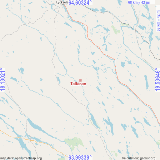
Tallåsen GPS coordinates[2]
64° 18' 0" North, 18° 49' 59.988" East
| Map corner | latitude | longitude |
|---|---|---|
| Upper-left | 64.60324°, | 18.13021° |
| Center: | 64.3°, | 18.83333° |
| Lower-right: | 63.99339°, | 19.53646° |
| Map W x H: | 67.8×67.8 km | = 42.1×42.1mi |
| max Lat: | 67.85572° ⇑6.1% North |
| Tallåsen: | 64.3° |
| min Lat: | ⇓93.9% South 55.34337° |
| min Long | Tallåsen | max Long |
| 11.1712° | 18.83333° | 24.13676° |
| W 92.6%⇐ | ⇒7.4% E |
Elevation
Elevation of Tallåsen is 275 m = 902 ft, and this is 192.4 m = 631 ft above average elevation for this country.
| Max E: |
663 m = 2175 ft | 4.6% |
| Tallåsen | 275 m 902 ft | |
| Avg. | 82.6 m = 271 ft | |
Min E: |
-1 m = -3 ft | 95.4% |
See also: Sweden elevation on elevation.city.
Geographical zone
Tallåsen is located in North temperate zone (between Tropic of Cancer and the Arctic Circle). Distance of this North polar circle is 251.7 km =156.4 mi to North.| Distance of | km | miles | from Tallåsen |
|---|---|---|---|
| North Pole | 2857.6 | 1775.6 | to North |
| Arctic Circle | 251.7 | 156.4 | to North |
| Tropic Cancer | 4543.6 | 2823.3 | to South |
| Equator | 7149.5 | 4442.5 | to South |


Nearby cities:
15 places around Tallåsen: (largest is in red/bold)
• Bjurholm
45.1 km =28 mi,  155°
155°
• Ersmark
85.7 km =53.3 mi,  122°
122°
• Insjön
65.9 km =40.9 mi,  279°
279°
• Lycksele
33.7 km =20.9 mi,  346°
346°
• Nordmaling
87.7 km =54.5 mi, 158°
• Norsjö
74.7 km =46.4 mi,  24°
24°
• Ramsele
43.3 km =26.9 mi,  126°
126°
• Röbäck
85.6 km =53.2 mi, 129°
• Sunnansjö
33.5 km =20.8 mi, 131°
• Söderfors
68.6 km =42.6 mi,  326°
326°
• Umeå
87 km =54.1 mi, 127°
• Vindeln
44.2 km =27.5 mi,  104°
104°
• Vännäs
62.6 km =38.9 mi, 134°
• Vännäsby
64.4 km =40 mi, 131°
• Åsele
73.5 km =45.7 mi,  257°
257°
Sources, notices
• [Note1] Compared only with cities in Sweden existing in our database
• [Src1] Map data: © OpenStreetMap contributors (CC-BY-SA)
• [Src2] Other city data from geonames.org with taken over terms of usage.
• [Src3] Geographical zone / Annual Mean Temperature by Robert A. Rohde @ Wikipedia
