Lycksele geodata
Lycksele (Västerbotten) is a seat of a second-order administrative division; located in Sweden in Europe/Stockholm (GMT+2) time zone. With population of 8,545 people, there are 172 cities with bigger population in this country. Compared to other cities in Sweden, 94.2% of cities are located further ↓South; 91.9% of cities are located further ←West and 92.5% of cities have lower elevation than Lycksele. Note1


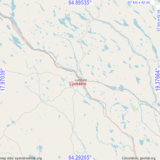
Lycksele GPS coordinates[2]
64° 35' 43.332" North, 18° 40' 24.636" East
| Map corner | latitude | longitude |
|---|---|---|
| Upper-left | 64.89535°, | 17.97039° |
| Center: | 64.59537°, | 18.67351° |
| Lower-right: | 64.29205°, | 19.37664° |
| Map W x H: | 67.1×67.1 km | = 41.7×41.7mi |
| max Lat: | 67.85572° ⇑5.8% North |
| Lycksele: | 64.59537° |
| min Lat: | ⇓94.2% South 55.34337° |
| min Long | Lycksele | max Long |
| 11.1712° | 18.67351° | 24.13676° |
| W 91.9%⇐ | ⇒8.1% E |
Elevation
Elevation of Lycksele is 224 m = 735 ft, and this is 141.4 m = 464 ft above average elevation for this country.
| Max E: |
663 m = 2175 ft | 7.5% |
| Lycksele | 224 m 735 ft | |
| Avg. | 82.6 m = 271 ft | |
Min E: |
-1 m = -3 ft | 92.5% |
See also: Sweden elevation on elevation.city.
Geographical zone
Lycksele is located in North temperate zone (between Tropic of Cancer and the Arctic Circle). Distance of this North polar circle is 218.8 km =136 mi to North.| Distance of | km | miles | from Lycksele |
|---|---|---|---|
| North Pole | 2824.7 | 1755.2 | to North |
| Arctic Circle | 218.8 | 136 | to North |
| Tropic Cancer | 4576.4 | 2843.6 | to South |
| Equator | 7182.3 | 4462.9 | to South |


Nearby cities:
15 places around Lycksele: (largest is in red/bold)
• Bjurholm
78.4 km =48.7 mi,  160°
160°
• Boliden
86.6 km =53.8 mi,  69°
69°
• Forsbacka
88.9 km =55.2 mi,  77°
77°
• Insjön
61 km =37.9 mi,  249°
249°
• Jörn
82.6 km =51.3 mi,  51°
51°
• Långsele
78.8 km =49 mi, 71°
• Malå
65.6 km =40.8 mi,  2°
2°
• Norsjö
52 km =32.3 mi, 47°
• Ramsele
72.4 km =45 mi,  144°
144°
• Storuman
92.2 km =57.3 mi,  307°
307°
• Sunnansjö
64 km =39.8 mi,  149°
149°
• Söderfors
38.5 km =23.9 mi, 309°
• Tallåsen
33.7 km =20.9 mi,  166°
166°
• Vindeln
66.6 km =41.4 mi,  131°
131°
• Åsele
80 km =49.7 mi,  232°
232°
Sources, notices
• [Note1] Compared only with cities in Sweden existing in our database
• [Src1] Map data: © OpenStreetMap contributors (CC-BY-SA)
• [Src2] Other city data from geonames.org with taken over terms of usage.
• [Src3] Geographical zone / Annual Mean Temperature by Robert A. Rohde @ Wikipedia
