Ankarsrum geodata
Ankarsrum (Kalmar) is a populated place; located in Sweden in Europe/Stockholm (GMT+2) time zone. With population of 1,234 people, there are 731 cities with bigger population in this country. Compared to other cities in Sweden, 68% of cities are located further ↑North; 66% of cities are located further ←West and 54% of cities have lower elevation than Ankarsrum. Note1


Ankarsrum GPS coordinates[2]
57° 41' 56.256" North, 16° 20' 2.652" East
| Map corner | latitude | longitude |
|---|---|---|
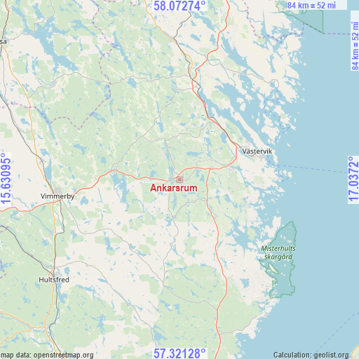
| Upper-left | 58.07274°, | 15.63095° |
| Center: | 57.69896°, | 16.33407° |
| Lower-right: | 57.32128°, | 17.0372° |
| Map W x H: | 83.6×83.6 km | = 51.9×51.9mi |
| max Lat: | 67.85572° ⇑68% North |
| Ankarsrum: | 57.69896° |
| min Lat: | ⇓32% South 55.34337° |
| min Long | Ankarsrum | max Long |
| 11.1712° | 16.33407° | 24.13676° |
| W 66%⇐ | ⇒34% E |
Elevation
Elevation of Ankarsrum is 57 m = 187 ft, and this is 25.6 m = 84 ft below average elevation for this country.
| Max E: |
663 m = 2175 ft | 46% |
| Avg. | 82.6 m = 271 ft | |
| Ankarsrum | 57 m = 187 ft | |
Min E: |
-1 m = -3 ft | 54% |
See also: Sweden elevation on elevation.city.
Geographical zone
Ankarsrum is located in North temperate zone (between Tropic of Cancer and the Arctic Circle). Distance of this North polar circle is 985.7 km =612.5 mi to North.| Distance of | km | miles | from Ankarsrum |
|---|---|---|---|
| North Pole | 3591.5 | 2231.7 | to North |
| Arctic Circle | 985.7 | 612.5 | to North |
| Tropic Cancer | 3809.6 | 2367.2 | to South |
| Equator | 6415.5 | 3986.4 | to South |


Nearby cities:
15 places around Ankarsrum: (largest is in red/bold)
• Figeholm
39.1 km =24.3 mi,  160°
160°
• Gamleby
22.2 km =13.8 mi,  10°
10°
• Gullringen
39.3 km =24.4 mi,  286°
286°
• Gunnebo
12 km =7.5 mi,  80°
80°
• Horn
37.1 km =23.1 mi,  306°
306°
• Hultsfred
37.5 km =23.3 mi,  231°
231°
• Kristdala
34 km =21.1 mi,  193°
193°
• Mariannelund
46.6 km =29 mi,  258°
258°
• Piperskärr
20.1 km =12.5 mi,  62°
62°
• Silverdalen
38.9 km =24.2 mi,  243°
243°
• Storebro
31.5 km =19.6 mi,  245°
245°
• Södra Vi
32.4 km =20.1 mi,  278°
278°
• Vimmerby
28.7 km =17.8 mi, 262°
• Västervik
19.2 km =11.9 mi,  69°
69°
• Överum
32.2 km =20 mi,  357°
357°
Sources, notices
• [Note1] Compared only with cities in Sweden existing in our database
• [Src1] Map data: © OpenStreetMap contributors (CC-BY-SA)
• [Src2] Other city data from geonames.org with taken over terms of usage.
• [Src3] Geographical zone / Annual Mean Temperature by Robert A. Rohde @ Wikipedia
