Hummelsta geodata
Hummelsta (Uppsala) is a populated place; located in Sweden in Europe/Stockholm (GMT+2) time zone. With population of 994 people, there are 818 cities with bigger population in this country. Compared to other cities in Sweden, 68.9% of cities are located further ↓South; 73.1% of cities are located further ←West and 62.9% of cities have higher elevation than Hummelsta. Note1


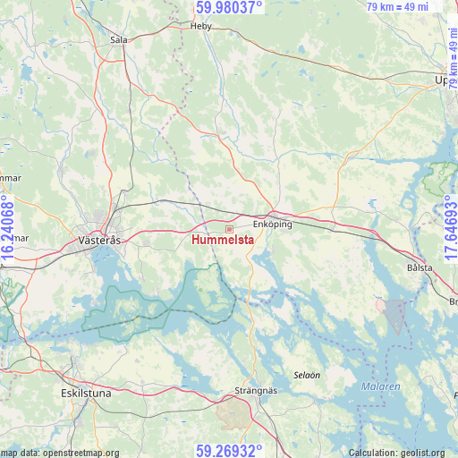
Hummelsta GPS coordinates[2]
59° 37' 36.228" North, 16° 56' 37.68" East
| Map corner | latitude | longitude |
|---|---|---|
| Upper-left | 59.98037°, | 16.24068° |
| Center: | 59.62673°, | 16.9438° |
| Lower-right: | 59.26932°, | 17.64693° |
| Map W x H: | 79.1×79.1 km | = 49.2×49.2mi |
| max Lat: | 67.85572° ⇑31.1% North |
| Hummelsta: | 59.62673° |
| min Lat: | ⇓68.9% South 55.34337° |
| min Long | Hummelsta | max Long |
| 11.1712° | 16.9438° | 24.13676° |
| W 73.1%⇐ | ⇒26.9% E |
Elevation
Elevation of Hummelsta is 32 m = 105 ft, and this is 50.6 m = 166 ft below average elevation for this country.
| Max E: |
663 m = 2175 ft | 62.9% |
| Avg. | 82.6 m = 271 ft | |
| Hummelsta | 32 m = 105 ft | |
Min E: |
-1 m = -3 ft | 37.1% |
See also: Sweden elevation on elevation.city.
Geographical zone
Hummelsta is located in North temperate zone (between Tropic of Cancer and the Arctic Circle). Distance of this North polar circle is 771.3 km =479.3 mi to North.| Distance of | km | miles | from Hummelsta |
|---|---|---|---|
| North Pole | 3377.2 | 2098.5 | to North |
| Arctic Circle | 771.3 | 479.3 | to North |
| Tropic Cancer | 4024 | 2500.4 | to South |
| Equator | 6629.9 | 4119.6 | to South |


Nearby cities:
15 places around Hummelsta: (largest is in red/bold)
• Barkarö
26 km =16.2 mi,  250°
250°
• Bredsand
8.4 km =5.2 mi,  124°
124°
• Enhagen-Ekbacken
24.2 km =15 mi, 253°
• Enköping
7.6 km =4.7 mi,  82°
82°
• Fjärdhundra
16.6 km =10.3 mi,  355°
355°
• Grillby
17.7 km =11 mi,  90°
90°
• Härad
29.7 km =18.5 mi,  184°
184°
• Hökåsen
20.7 km =12.9 mi,  282°
282°
• Irsta
8.2 km =5.1 mi, 355°
• Irsta
14 km =8.7 mi,  257°
257°
• Ransta
26.7 km =16.6 mi,  319°
319°
• Strängnäs
28.2 km =17.5 mi,  169°
169°
• Tillberga
19.4 km =12.1 mi,  288°
288°
• Västerås
22 km =13.7 mi,  266°
266°
• Örsundsbro
23.2 km =14.4 mi,  59°
59°
Sources, notices
• [Note1] Compared only with cities in Sweden existing in our database
• [Src1] Map data: © OpenStreetMap contributors (CC-BY-SA)
• [Src2] Other city data from geonames.org with taken over terms of usage.
• [Src3] Geographical zone / Annual Mean Temperature by Robert A. Rohde @ Wikipedia
