Forssjö geodata
Forssjö (Södermanland) is a populated place; located in Sweden in Europe/Stockholm (GMT+2) time zone. With population of 525 people, there are 1281 cities with bigger population in this country. Compared to other cities in Sweden, 52.9% of cities are located further ↓South; 65.3% of cities are located further ←West and 54.7% of cities have higher elevation than Forssjö. Note1
Administrative division(s):
- Level 1: Södermanland
- Level 2: Katrineholms Kommun
- Level 3: Katrineholm-Stora Malm
- Level 4: Stora Malm socken


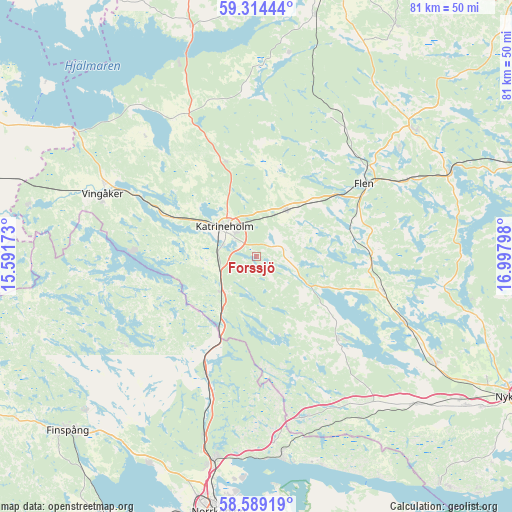
Forssjö GPS coordinates[2]
58° 57' 13.392" North, 16° 17' 41.46" East
| Map corner | latitude | longitude |
|---|---|---|
| Upper-left | 59.31444°, | 15.59173° |
| Center: | 58.95372°, | 16.29485° |
| Lower-right: | 58.58919°, | 16.99798° |
| Map W x H: | 80.6×80.6 km | = 50.1×50.1mi |
| max Lat: | 67.85572° ⇑47.1% North |
| Forssjö: | 58.95372° |
| min Lat: | ⇓52.9% South 55.34337° |
| min Long | Forssjö | max Long |
| 11.1712° | 16.29485° | 24.13676° |
| W 65.3%⇐ | ⇒34.7% E |
Elevation
Elevation of Forssjö is 43 m = 141 ft, and this is 39.6 m = 130 ft below average elevation for this country.
| Max E: |
663 m = 2175 ft | 54.7% |
| Avg. | 82.6 m = 271 ft | |
| Forssjö | 43 m = 141 ft | |
Min E: |
-1 m = -3 ft | 45.3% |
See also: Sweden elevation on elevation.city.
Geographical zone
Forssjö is located in North temperate zone (between Tropic of Cancer and the Arctic Circle). Distance of this North polar circle is 846.1 km =525.7 mi to North.| Distance of | km | miles | from Forssjö |
|---|---|---|---|
| North Pole | 3452 | 2145 | to North |
| Arctic Circle | 846.1 | 525.7 | to North |
| Tropic Cancer | 3949.1 | 2453.9 | to South |
| Equator | 6555 | 4073.1 | to South |


Nearby cities:
15 places around Forssjö: (largest is in red/bold)
• Bie
15.8 km =9.8 mi,  342°
342°
• Flen
20.4 km =12.7 mi,  55°
55°
• Hälleforsnäs
24.9 km =15.5 mi,  27°
27°
• Katrineholm
6.9 km =4.3 mi,  313°
313°
• Krokek
31.6 km =19.6 mi,  172°
172°
• Malmköping
32.1 km =19.9 mi,  51°
51°
• Mellösa
21.9 km =13.6 mi,  41°
41°
• Olstorp
24.7 km =15.3 mi,  128°
128°
• Rejmyre
25.5 km =15.8 mi,  238°
238°
• Sköldinge
12.2 km =7.6 mi, 45°
• Sparreholm
32.4 km =20.1 mi,  67°
67°
• Strömsfors
30.5 km =19 mi,  176°
176°
• Valla
8.6 km =5.3 mi, 35°
• Vingåker
26.1 km =16.2 mi,  292°
292°
• Vrena
25.4 km =15.8 mi,  113°
113°
Sources, notices
• [Note1] Compared only with cities in Sweden existing in our database
• [Src1] Map data: © OpenStreetMap contributors (CC-BY-SA)
• [Src2] Other city data from geonames.org with taken over terms of usage.
• [Src3] Geographical zone / Annual Mean Temperature by Robert A. Rohde @ Wikipedia
