Anderstorp geodata
Anderstorp (Västra Götaland) is a populated place; located in Sweden in Europe/Stockholm (GMT+2) time zone. With population of 4,987 people, there are 274 cities with bigger population in this country. Compared to other cities in Sweden, 52.1% of cities are located further ↓South; 59.6% of cities are located further →East and 82.8% of cities have lower elevation than Anderstorp. Note1


Anderstorp GPS coordinates[2]
58° 52' 59.988" North, 14° 16' 59.988" East
| Map corner | latitude | longitude |
|---|---|---|
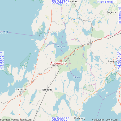
| Upper-left | 59.24479°, | 13.58021° |
| Center: | 58.88333°, | 14.28333° |
| Lower-right: | 58.51805°, | 14.98646° |
| Map W x H: | 80.8×80.8 km | = 50.2×50.2mi |
| max Lat: | 67.85572° ⇑47.9% North |
| Anderstorp: | 58.88333° |
| min Lat: | ⇓52.1% South 55.34337° |
| min Long | Anderstorp | max Long |
| 11.1712° | 14.28333° | 24.13676° |
| W 40.4%⇐ | ⇒59.6% E |
Elevation
Elevation of Anderstorp is 157 m = 515 ft, and this is 74.4 m = 244 ft above average elevation for this country.
| Max E: |
663 m = 2175 ft | 17.2% |
| Anderstorp | 157 m 515 ft | |
| Avg. | 82.6 m = 271 ft | |
Min E: |
-1 m = -3 ft | 82.8% |
See also: Sweden elevation on elevation.city.
Geographical zone
Anderstorp is located in North temperate zone (between Tropic of Cancer and the Arctic Circle). Distance of this North polar circle is 854 km =530.7 mi to North.| Distance of | km | miles | from Anderstorp |
|---|---|---|---|
| North Pole | 3459.8 | 2149.8 | to North |
| Arctic Circle | 854 | 530.7 | to North |
| Tropic Cancer | 3941.3 | 2449 | to South |
| Equator | 6547.2 | 4068.2 | to South |


Nearby cities:
15 places around Anderstorp: (largest is in red/bold)
• Askersund
35.6 km =22.1 mi,  90°
90°
• Baggetorp
35.8 km =22.2 mi,  34°
34°
• Björneborg
39.8 km =24.7 mi,  357°
357°
• Finnerödja
10.3 km =6.4 mi,  57°
57°
• Gullspång
15.7 km =9.8 mi,  316°
316°
• Hova
5 km =3.1 mi,  228°
228°
• Laxå
22.4 km =13.9 mi, 59°
• Mariestad
32.8 km =20.4 mi, 233°
• Moholm
33.9 km =21.1 mi,  204°
204°
• Mullhyttan
37.5 km =23.3 mi,  37°
37°
• Otterbäcken
16.2 km =10.1 mi,  297°
297°
• Tidan
37.9 km =23.5 mi,  205°
205°
• Töreboda
21.6 km =13.4 mi, 204°
• Ullervad
34 km =21.1 mi,  224°
224°
• Vretstorp
37.4 km =23.2 mi, 63°
Sources, notices
• [Note1] Compared only with cities in Sweden existing in our database
• [Src1] Map data: © OpenStreetMap contributors (CC-BY-SA)
• [Src2] Other city data from geonames.org with taken over terms of usage.
• [Src3] Geographical zone / Annual Mean Temperature by Robert A. Rohde @ Wikipedia
