Seidu geodata
Seidu (Northern Province) is a populated place; located in Sierra Leone in Africa/Freetown (GMT+0) time zone. With population of 2,243 people, there are 81 cities with bigger population in this country. Compared to other cities in Sierra Leone, 89.2% of cities are located further ↓South; 97.6% of cities are located further ←West and 100% of cities have lower elevation than Seidu. Note1


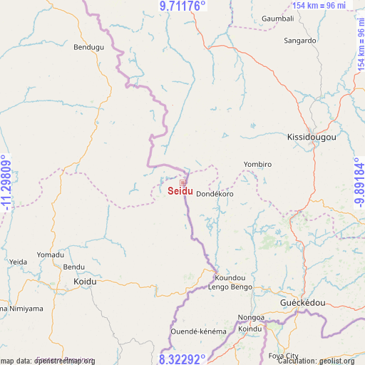
Seidu GPS coordinates[2]
9° 1' 4.836" North, 10° 35' 41.856" West
| Map corner | latitude | longitude |
|---|---|---|
| Upper-left | 9.71176°, | -11.29809° |
| Center: | 9.01801°, | -10.59496° |
| Lower-right: | 8.32292°, | -9.89184° |
| Map W x H: | 154.4×154.4 km | = 95.9×95.9mi |
| max Lat: | 9.91376° ⇑10.8% North |
| Seidu: | 9.01801° |
| min Lat: | ⇓89.2% South 7.24611° |
| min Long | Seidu | max Long |
| -13.28972° | -10.59496° | -10.37135° |
| W 97.6%⇐ | ⇒2.4% E |
Elevation
Elevation of Seidu is 564 m = 1850 ft, and this is 406.8 m = 1335 ft above average elevation for this country.
| Max E: |
564 m = 1850 ft | 0% |
| Seidu | 564 m 1850 ft | |
| Avg. | 157.2 m = 516 ft | |
Min E: |
1 m = 3 ft | 100% |
See also: Sierra Leone elevation on elevation.city.
Geographical zone
Seidu is located in North Torrid zone (between Equator and Tropic of Cancer). Distance of Equator is 1002.7 km =623 mi to South.| Distance of | km | miles | from Seidu |
|---|---|---|---|
| North Pole | 9004.4 | 5595.1 | to North |
| Arctic Circle | 6398.5 | 3975.8 | to North |
| Tropic Cancer | 1603.2 | 996.2 | to North |
| Equator | 1002.7 | 623 | to South |


Nearby cities:
15 places around Seidu: (largest is in red/bold)
• Alikalia
88.3 km =54.9 mi,  279°
279°
• Buedu
85.7 km =53.3 mi,  163°
163°
• Bunumbu
98.4 km =61.1 mi,  197°
197°
• Giehun
71.2 km =44.2 mi,  223°
223°
• Kailahun
82.2 km =51.1 mi,  178°
178°
• Kayima
63.7 km =39.6 mi,  256°
256°
• Koidu
58.7 km =36.5 mi, 224°
• Koyima
58.4 km =36.3 mi,  233°
233°
• Manowa
95.4 km =59.3 mi,  190°
190°
• Motema
64.2 km =39.9 mi, 225°
• Simbakoro
63.9 km =39.7 mi, 225°
• Tefeya
76.3 km =47.4 mi,  242°
242°
• Tombodu
98.2 km =61 mi, 181°
• Tombu
55.2 km =34.3 mi, 195°
• Yengema
71.7 km =44.6 mi, 241°
Sources, notices
• [Note1] Compared only with cities in Sierra Leone existing in our database
• [Src1] Map data: © OpenStreetMap contributors (CC-BY-SA)
• [Src2] Other city data from geonames.org with taken over terms of usage.
• [Src3] Geographical zone / Annual Mean Temperature by Robert A. Rohde @ Wikipedia
