Rokupr geodata
Rokupr (Northern Province) is a populated place; located in Sierra Leone in Africa/Freetown (GMT+0) time zone. With population of 12,504 people, there are 15 cities with bigger population in this country. Compared to other cities in Sierra Leone, 71.1% of cities are located further ↓South; 75.9% of cities are located further →East and 59% of cities have higher elevation than Rokupr. Note1


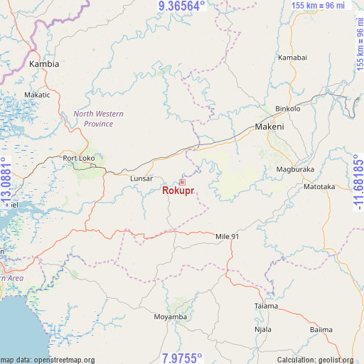
Rokupr GPS coordinates[2]
8° 40' 16.356" North, 12° 23' 5.892" West
| Map corner | latitude | longitude |
|---|---|---|
| Upper-left | 9.36564°, | -13.0881° |
| Center: | 8.67121°, | -12.38497° |
| Lower-right: | 7.9755°, | -11.68185° |
| Map W x H: | 154.6×154.6 km | = 96.1×96.1mi |
| max Lat: | 9.91376° ⇑28.9% North |
| Rokupr: | 8.67121° |
| min Lat: | ⇓71.1% South 7.24611° |
| min Long | Rokupr | max Long |
| -13.28972° | -12.38497° | -10.37135° |
| W 24.1%⇐ | ⇒75.9% E |
Elevation
Elevation of Rokupr is 83 m = 272 ft, and this is 74.2 m = 243 ft below average elevation for this country.
| Max E: |
564 m = 1850 ft | 59% |
| Avg. | 157.2 m = 516 ft | |
| Rokupr | 83 m = 272 ft | |
Min E: |
1 m = 3 ft | 41% |
See also: Sierra Leone elevation on elevation.city.
Geographical zone
Rokupr is located in North Torrid zone (between Equator and Tropic of Cancer). Distance of Equator is 964.1 km =599.1 mi to South.| Distance of | km | miles | from Rokupr |
|---|---|---|---|
| North Pole | 9042.9 | 5619 | to North |
| Arctic Circle | 6437 | 3999.8 | to North |
| Tropic Cancer | 1641.8 | 1020.2 | to North |
| Equator | 964.1 | 599.1 | to South |


Nearby cities:
15 places around Rokupr: (largest is in red/bold)
• Binkolo
54.3 km =33.7 mi,  54°
54°
• Kambia
77.3 km =48 mi,  310°
310°
• Largo
50.3 km =31.3 mi,  150°
150°
• Lunsar
16.6 km =10.3 mi,  275°
275°
• Magburaka
48.3 km =30 mi,  83°
83°
• Makeni
44.4 km =27.6 mi,  57°
57°
• Mambolo
76.7 km =47.7 mi,  291°
291°
• Mange
58.9 km =36.6 mi,  298°
298°
• Masaka
64 km =39.8 mi,  90°
90°
• Masingbi
49.2 km =30.6 mi, 75°
• Moyamba
57.2 km =35.5 mi,  185°
185°
• Pepel
74.2 km =46.1 mi,  262°
262°
• Port Loko
45.4 km =28.2 mi, 283°
• Rotifunk
59.1 km =36.7 mi,  213°
213°
• Yonibana
30 km =18.6 mi, 147°
Sources, notices
• [Note1] Compared only with cities in Sierra Leone existing in our database
• [Src1] Map data: © OpenStreetMap contributors (CC-BY-SA)
• [Src2] Other city data from geonames.org with taken over terms of usage.
• [Src3] Geographical zone / Annual Mean Temperature by Robert A. Rohde @ Wikipedia
