Raja geodata
Raja (Lol) is a seat of a first-order administrative division; located in South Sudan in Africa/Juba (GMT+2) time zone. With population of 3,700 people, there are 18 cities with bigger population in this country. Compared to other cities in South Sudan, 66.7% of cities are located further ↓South; 100% of cities are located further →East and 75.8% of cities have lower elevation than Raja. Note1


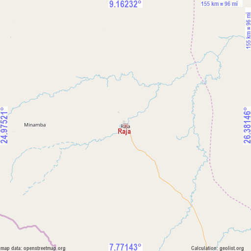
Raja GPS coordinates[2]
8° 28' 3" North, 25° 40' 41.988" East
| Map corner | latitude | longitude |
|---|---|---|
| Upper-left | 9.16232°, | 24.97521° |
| Center: | 8.4675°, | 25.67833° |
| Lower-right: | 7.77143°, | 26.38146° |
| Map W x H: | 154.7×154.7 km | = 96.1×96.1mi |
| max Lat: | 11.7431° ⇑33.3% North |
| Raja: | 8.4675° |
| min Lat: | ⇓66.7% South 3.86512° |
| min Long | Raja | max Long |
| 25.67833° | 25.67833° | 33.92621° |
| W 0%⇐ | ⇒100% E |
Elevation
Elevation of Raja is 558 m = 1831 ft, and this is 69.1 m = 227 ft above average elevation for this country.
| Max E: |
836 m = 2743 ft | 24.2% |
| Raja | 558 m 1831 ft | |
| Avg. | 488.9 m = 1604 ft | |
Min E: |
392 m = 1286 ft | 75.8% |
See also: South Sudan elevation on elevation.city.
Geographical zone
Raja is located in North Torrid zone (between Equator and Tropic of Cancer). Distance of Equator is 941.5 km =585 mi to South.| Distance of | km | miles | from Raja |
|---|---|---|---|
| North Pole | 9065.6 | 5633.1 | to North |
| Arctic Circle | 6459.7 | 4013.9 | to North |
| Tropic Cancer | 1664.4 | 1034.2 | to North |
| Equator | 941.5 | 585 | to South |


Nearby cities:
9 places around Raja: (largest is in red/bold)
• Aweil
191.2 km =118.8 mi,  80°
80°
• Cueibet
424.5 km =263.8 mi,  112°
112°
• Gogrial
266.4 km =165.5 mi,  88°
88°
• Kuacjok
253.8 km =157.7 mi, 94°
• Mayen Abun
302.4 km =187.9 mi, 75°
• Tambura
375 km =233 mi,  148°
148°
• Tonj
356 km =221.2 mi, 111°
• Wau
268.3 km =166.7 mi, 108°
• Winejok
216.6 km =134.6 mi,  73°
73°
Sources, notices
• [Note1] Compared only with cities in South Sudan existing in our database
• [Src1] Map data: © OpenStreetMap contributors (CC-BY-SA)
• [Src2] Other city data from geonames.org with taken over terms of usage.
• [Src3] Geographical zone / Annual Mean Temperature by Robert A. Rohde @ Wikipedia
