Winejok geodata
Winejok (Aweil East) is a seat of a first-order administrative division; located in South Sudan in Africa/Juba (GMT+2) time zone. With population of 300,000 people, there is 1 city with bigger population in this country. Compared to other cities in South Sudan, 81.8% of cities are located further ↓South; 90.9% of cities are located further →East and 63.6% of cities have higher elevation than Winejok. Note1


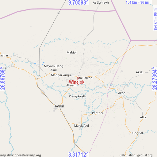
Winejok GPS coordinates[2]
9° 0' 43.992" North, 27° 34' 14.916" East
| Map corner | latitude | longitude |
|---|---|---|
| Upper-left | 9.70598°, | 26.86769° |
| Center: | 9.01222°, | 27.57081° |
| Lower-right: | 8.31712°, | 28.27394° |
| Map W x H: | 154.4×154.4 km | = 95.9×95.9mi |
| max Lat: | 11.7431° ⇑18.2% North |
| Winejok: | 9.01222° |
| min Lat: | ⇓81.8% South 3.86512° |
| min Long | Winejok | max Long |
| 25.67833° | 27.57081° | 33.92621° |
| W 9.1%⇐ | ⇒90.9% E |
Elevation
Elevation of Winejok is 419 m = 1375 ft, and this is 69.9 m = 229 ft below average elevation for this country.
| Max E: |
836 m = 2743 ft | 63.6% |
| Avg. | 488.9 m = 1604 ft | |
| Winejok | 419 m = 1375 ft | |
Min E: |
392 m = 1286 ft | 36.4% |
See also: Winejok elevation on elevation.city.
Geographical zone
Winejok is located in North Torrid zone (between Equator and Tropic of Cancer). Distance of Equator is 1002.1 km =622.7 mi to South.| Distance of | km | miles | from Winejok |
|---|---|---|---|
| North Pole | 9005 | 5595.4 | to North |
| Arctic Circle | 6399.1 | 3976.2 | to North |
| Tropic Cancer | 1603.9 | 996.6 | to North |
| Equator | 1002.1 | 622.7 | to South |


Nearby cities:
15 places around Winejok: (largest is in red/bold)
• Aweil
34.1 km =21.2 mi,  215°
215°
• Ayod
433.5 km =269.4 mi,  103°
103°
• Bentiu
246 km =152.9 mi,  83°
83°
• Cueibet
287.7 km =178.8 mi,  140°
140°
• Gogrial
78.9 km =49 mi,  132°
132°
• Kuacjok
90.8 km =56.4 mi,  150°
150°
• Leer
293.3 km =182.2 mi,  105°
105°
• Mayen Abun
86.2 km =53.6 mi, 80°
• Pariang
282.8 km =175.7 mi,  69°
69°
• Raja
216.6 km =134.6 mi,  253°
253°
• Rumbek
337.6 km =209.8 mi, 136°
• Tambura
379.6 km =235.9 mi,  181°
181°
• Tonj
228.5 km =142 mi, 147°
• Wau
152.9 km =95 mi,  162°
162°
• Yirol
422.8 km =262.7 mi, 130°
Sources, notices
• [Note1] Compared only with cities in South Sudan existing in our database
• [Src1] Map data: © OpenStreetMap contributors (CC-BY-SA)
• [Src2] Other city data from geonames.org with taken over terms of usage.
• [Src3] Geographical zone / Annual Mean Temperature by Robert A. Rohde @ Wikipedia
