Gogrial geodata
Gogrial is a populated place; located in South Sudan in Africa/Juba (GMT+2) time zone. With population of 38,572 people, there are 8 cities with bigger population in this country. Compared to other cities in South Sudan, 69.7% of cities are located further ↓South; 81.8% of cities are located further →East and 66.7% of cities have higher elevation than Gogrial. Note1


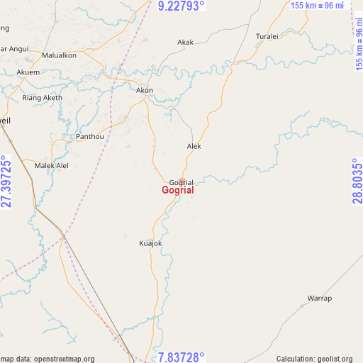
Gogrial GPS coordinates[2]
8° 31' 59.664" North, 28° 6' 1.332" East
| Map corner | latitude | longitude |
|---|---|---|
| Upper-left | 9.22793°, | 27.39725° |
| Center: | 8.53324°, | 28.10037° |
| Lower-right: | 7.83728°, | 28.8035° |
| Map W x H: | 154.6×154.6 km | = 96.1×96.1mi |
| max Lat: | 11.7431° ⇑30.3% North |
| Gogrial: | 8.53324° |
| min Lat: | ⇓69.7% South 3.86512° |
| min Long | Gogrial | max Long |
| 25.67833° | 28.10037° | 33.92621° |
| W 18.2%⇐ | ⇒81.8% E |
Elevation
Elevation of Gogrial is 414 m = 1358 ft, and this is 74.9 m = 246 ft below average elevation for this country.
| Max E: |
836 m = 2743 ft | 66.7% |
| Avg. | 488.9 m = 1604 ft | |
| Gogrial | 414 m = 1358 ft | |
Min E: |
392 m = 1286 ft | 33.3% |
See also: South Sudan elevation on elevation.city.
Geographical zone
Gogrial is located in North Torrid zone (between Equator and Tropic of Cancer). Distance of Equator is 948.8 km =589.6 mi to South.| Distance of | km | miles | from Gogrial |
|---|---|---|---|
| North Pole | 9058.3 | 5628.6 | to North |
| Arctic Circle | 6452.4 | 4009.3 | to North |
| Tropic Cancer | 1657.1 | 1029.7 | to North |
| Equator | 948.8 | 589.6 | to South |


Nearby cities:
15 places around Gogrial: (largest is in red/bold)
• Aweil
81.9 km =50.9 mi,  288°
288°
• Ayod
366.9 km =228 mi,  97°
97°
• Bentiu
203.2 km =126.3 mi,  66°
66°
• Cueibet
209.7 km =130.3 mi,  143°
143°
• Kuacjok
28.8 km =17.9 mi,  207°
207°
• Leer
225.9 km =140.4 mi, 96°
• Mayen Abun
72.3 km =44.9 mi,  21°
21°
• Pariang
257.3 km =159.9 mi,  53°
53°
• Raja
266.4 km =165.5 mi,  268°
268°
• Rumbek
259 km =160.9 mi, 137°
• Tambura
333.6 km =207.3 mi,  192°
192°
• Tonj
153.8 km =95.6 mi,  155°
155°
• Wau
93.3 km =58 mi, 187°
• Winejok
78.9 km =49 mi,  312°
312°
• Yirol
344 km =213.8 mi,  129°
129°
Sources, notices
• [Note1] Compared only with cities in South Sudan existing in our database
• [Src1] Map data: © OpenStreetMap contributors (CC-BY-SA)
• [Src2] Other city data from geonames.org with taken over terms of usage.
• [Src3] Geographical zone / Annual Mean Temperature by Robert A. Rohde @ Wikipedia
