Tchoban Bey geodata
Tchoban Bey (Aleppo) is a seat of a third-order administrative division; located in Syria in Asia/Damascus (GMT+3) time zone. In our database, there are 87 cities with bigger population. Compared to other cities in Syria, 93.3% of cities are located further ↓South; 78.4% of cities are located further ←West and 55.1% of cities have lower elevation than Tchoban Bey. Note1


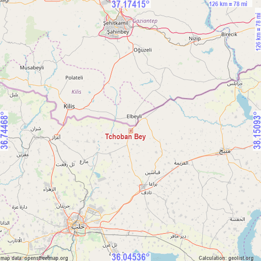
Tchoban Bey GPS coordinates[2]
36° 36' 42.552" North, 37° 26' 52.08" East
| Map corner | latitude | longitude |
|---|---|---|
| Upper-left | 37.17415°, | 36.74468° |
| Center: | 36.61182°, | 37.4478° |
| Lower-right: | 36.04536°, | 38.15093° |
| Map W x H: | 125.5×125.5 km | = 78×78mi |
| max Lat: | 37.17701° ⇑6.7% North |
| Tchoban Bey: | 36.61182° |
| min Lat: | ⇓93.3% South 32.39332° |
| min Long | Tchoban Bey | max Long |
| 35.75572° | 37.4478° | 42.14006° |
| W 78.4%⇐ | ⇒21.6% E |
Elevation
Elevation of Tchoban Bey is 496 m = 1627 ft, and this is 33.1 m = 109 ft below average elevation for this country.
| Max E: |
1640 m = 5381 ft | 44.9% |
| Avg. | 529.1 m = 1736 ft | |
| Tchoban Bey | 496 m = 1627 ft | |
Min E: |
4 m = 13 ft | 55.1% |
See also: Syria elevation on elevation.city.
Geographical zone
Tchoban Bey is located in North temperate zone (between Tropic of Cancer and the Arctic Circle). Distance of this Northern Tropic circle is 1464.9 km =910.2 mi to South.| Distance of | km | miles | from Tchoban Bey |
|---|---|---|---|
| North Pole | 5936.2 | 3688.6 | to North |
| Arctic Circle | 3330.3 | 2069.4 | to North |
| Tropic Cancer | 1464.9 | 910.2 | to South |
| Equator | 4070.9 | 2529.5 | to South |


Nearby cities:
15 places around Tchoban Bey: (largest is in red/bold)
• Akhtarīn
15.1 km =9.4 mi,  221°
221°
• Al Bāb
27.5 km =17.1 mi,  167°
167°
• Al Ghandūrah
26.2 km =16.3 mi,  75°
75°
• Al ‘Arīmah
28.9 km =18 mi,  122°
122°
• I‘zāz
36 km =22.4 mi,  265°
265°
• Kafr Şaghīr
39.4 km =24.5 mi,  205°
205°
• Manbij
46.2 km =28.7 mi,  101°
101°
• Māri‘
26.6 km =16.5 mi,  237°
237°
• Nubl
48.2 km =30 mi, 237°
• Rasm al Ḩarmal
47.3 km =29.4 mi,  149°
149°
• Sharān
45.6 km =28.3 mi, 271°
• Tall Rif‘at
35.2 km =21.9 mi, 243°
• Tādif
30.2 km =18.8 mi, 165°
• Şūrān
21.6 km =13.4 mi,  256°
256°
• Ḩuraytān
48.4 km =30.1 mi, 222°
Sources, notices
• [Note1] Compared only with cities in Syria existing in our database
• [Src1] Map data: © OpenStreetMap contributors (CC-BY-SA)
• [Src2] Other city data from geonames.org with taken over terms of usage.
• [Src3] Geographical zone / Annual Mean Temperature by Robert A. Rohde @ Wikipedia
