Kafr Şaghīr geodata
Kafr Şaghīr (Aleppo) is a populated place; located in Syria in Asia/Damascus (GMT+3) time zone. With population of 3,130 people, there are 85 cities with bigger population in this country. Compared to other cities in Syria, 85.5% of cities are located further ↓South; 76% of cities are located further ←West and 51.2% of cities have higher elevation than Kafr Şaghīr. Note1


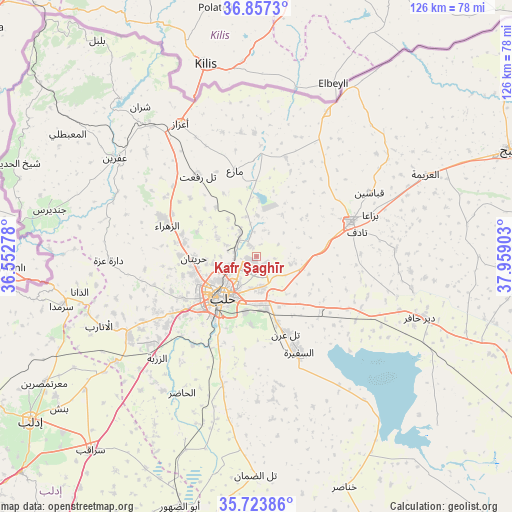
Kafr Şaghīr GPS coordinates[2]
36° 17' 33.504" North, 37° 15' 21.24" East
| Map corner | latitude | longitude |
|---|---|---|
| Upper-left | 36.8573°, | 36.55278° |
| Center: | 36.29264°, | 37.2559° |
| Lower-right: | 35.72386°, | 37.95903° |
| Map W x H: | 126×126 km | = 78.3×78.3mi |
| max Lat: | 37.17701° ⇑14.5% North |
| Kafr Şaghīr: | 36.29264° |
| min Lat: | ⇓85.5% South 32.39332° |
| min Long | Kafr Şaghīr | max Long |
| 35.75572° | 37.2559° | 42.14006° |
| W 76%⇐ | ⇒24% E |
Elevation
Elevation of Kafr Şaghīr is 464 m = 1522 ft, and this is 65.1 m = 214 ft below average elevation for this country.
| Max E: |
1640 m = 5381 ft | 51.2% |
| Avg. | 529.1 m = 1736 ft | |
| Kafr Şaghīr | 464 m = 1522 ft | |
Min E: |
4 m = 13 ft | 48.8% |
See also: Syria elevation on elevation.city.
Geographical zone
Kafr Şaghīr is located in North temperate zone (between Tropic of Cancer and the Arctic Circle). Distance of this Northern Tropic circle is 1429.4 km =888.2 mi to South.| Distance of | km | miles | from Kafr Şaghīr |
|---|---|---|---|
| North Pole | 5971.7 | 3710.6 | to North |
| Arctic Circle | 3365.8 | 2091.4 | to North |
| Tropic Cancer | 1429.4 | 888.2 | to South |
| Equator | 4035.4 | 2507.5 | to South |


Nearby cities:
15 places around Kafr Şaghīr: (largest is in red/bold)
• Akhtarīn
25.3 km =15.7 mi,  16°
16°
• Al Bāb
24.8 km =15.4 mi,  69°
69°
• Aleppo
13.2 km =8.2 mi,  219°
219°
• As Safīrah
26.2 km =16.3 mi,  156°
156°
• Az Zarbah
35.2 km =21.9 mi, 224°
• Banān
35.7 km =22.2 mi,  173°
173°
• Dārat ‘Izzah
36.2 km =22.5 mi,  268°
268°
• I‘zāz
37.7 km =23.4 mi,  330°
330°
• Kuwayris Sharqī
28.9 km =18 mi,  118°
118°
• Māri‘
21.8 km =13.5 mi,  346°
346°
• Nubl
25.4 km =15.8 mi,  292°
292°
• Tall Rif‘at
24.6 km =15.3 mi,  324°
324°
• Tādif
25.4 km =15.8 mi,  75°
75°
• Şūrān
30.6 km =19 mi, 352°
• Ḩuraytān
15.3 km =9.5 mi, 268°
Sources, notices
• [Note1] Compared only with cities in Syria existing in our database
• [Src1] Map data: © OpenStreetMap contributors (CC-BY-SA)
• [Src2] Other city data from geonames.org with taken over terms of usage.
• [Src3] Geographical zone / Annual Mean Temperature by Robert A. Rohde @ Wikipedia
