Aş Şanamayn geodata
Aş Şanamayn (Daraa) is a seat of a second-order administrative division; located in Syria in Asia/Damascus (GMT+3) time zone. With population of 25,702 people, there are 58 cities with bigger population in this country. Compared to other cities in Syria, 89.8% of cities are located further ↑North; 77% of cities are located further →East and 71.4% of cities have lower elevation than Aş Şanamayn. Note1


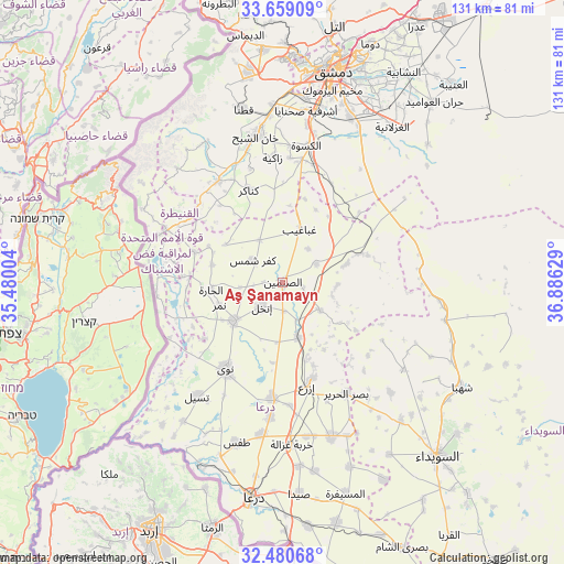
Aş Şanamayn GPS coordinates[2]
33° 4' 18.696" North, 36° 10' 59.376" East
| Map corner | latitude | longitude |
|---|---|---|
| Upper-left | 33.65909°, | 35.48004° |
| Center: | 33.07186°, | 36.18316° |
| Lower-right: | 32.48068°, | 36.88629° |
| Map W x H: | 131×131 km | = 81.4×81.4mi |
| max Lat: | 37.17701° ⇑89.8% North |
| Aş Şanamayn: | 33.07186° |
| min Lat: | ⇓10.2% South 32.39332° |
| min Long | Aş Şanamayn | max Long |
| 35.75572° | 36.18316° | 42.14006° |
| W 23%⇐ | ⇒77% E |
Elevation
Elevation of Aş Şanamayn is 642 m = 2106 ft, and this is 112.9 m = 370 ft above average elevation for this country.
| Max E: |
1640 m = 5381 ft | 28.6% |
| Aş Şanamayn | 642 m 2106 ft | |
| Avg. | 529.1 m = 1736 ft | |
Min E: |
4 m = 13 ft | 71.4% |
See also: Syria elevation on elevation.city.
Geographical zone
Aş Şanamayn is located in North temperate zone (between Tropic of Cancer and the Arctic Circle). Distance of this Northern Tropic circle is 1071.3 km =665.7 mi to South.| Distance of | km | miles | from Aş Şanamayn |
|---|---|---|---|
| North Pole | 6329.8 | 3933.2 | to North |
| Arctic Circle | 3723.9 | 2313.9 | to North |
| Tropic Cancer | 1071.3 | 665.7 | to South |
| Equator | 3677.2 | 2284.9 | to South |


Nearby cities:
15 places around Aş Şanamayn: (largest is in red/bold)
• Al Kiswah
32.3 km =20.1 mi,  9°
9°
• Al Qunayţirah
33.9 km =21.1 mi,  280°
280°
• Ash Shaykh Miskīn
27 km =16.8 mi,  184°
184°
• Aş Şūrah aş Şaghīrah
36.7 km =22.8 mi,  96°
96°
• Dā‘il
35.6 km =22.1 mi,  188°
188°
• Ghabāghib
12.9 km =8 mi,  17°
17°
• Inkhil
7.9 km =4.9 mi,  220°
220°
• Izra‘
23.3 km =14.5 mi,  163°
163°
• Jāsim
14.5 km =9 mi,  232°
232°
• Khān Arnabah
29.9 km =18.6 mi,  294°
294°
• Mismīyah
20.6 km =12.8 mi,  72°
72°
• Nawá
24.2 km =15 mi,  213°
213°
• Sa‘sa‘
27.9 km =17.3 mi,  326°
326°
• Tasīl
33.1 km =20.6 mi, 216°
• ‘Arīqah
34.6 km =21.5 mi,  125°
125°
Sources, notices
• [Note1] Compared only with cities in Syria existing in our database
• [Src1] Map data: © OpenStreetMap contributors (CC-BY-SA)
• [Src2] Other city data from geonames.org with taken over terms of usage.
• [Src3] Geographical zone / Annual Mean Temperature by Robert A. Rohde @ Wikipedia
